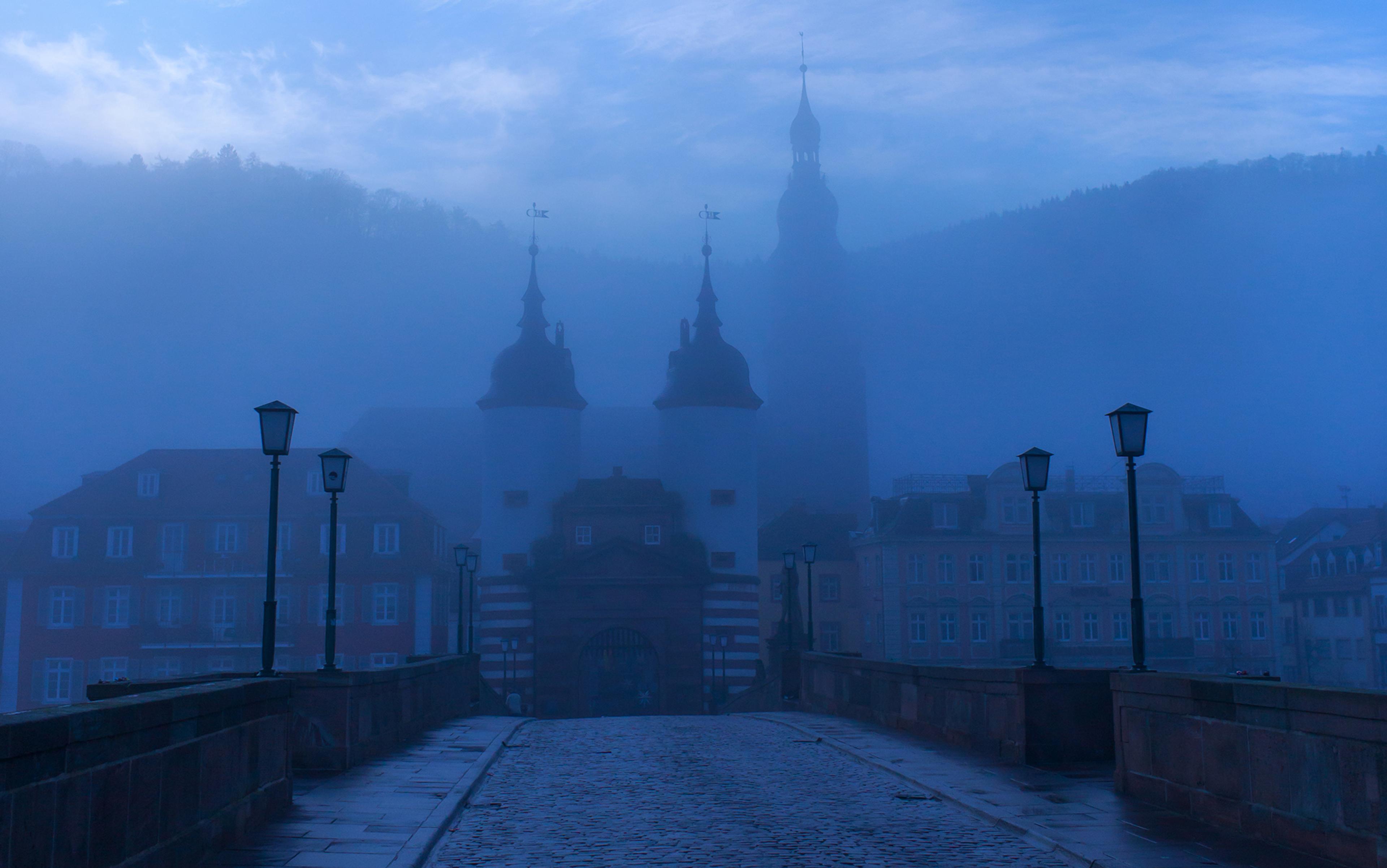
Wandering north up the Broad Walk, within the expansive and exquisitely manicured grounds of Kensington Gardens in west London, just past the grand Kensington Palace and up the whimsically curved ‘Wiggly Walk’ bordering the Sunken Garden, one soon arrives at the Orangery. On a clear summer day, the brick and glass façade of this garden pavilion casts a warm glow upon those gathered on its stately veranda to sip hot tea and indulge in brunch. I found myself there on a recent sunny afternoon, perched on wrought-iron chairs with a student of mine, enjoying the expansive view of the park to the south, while we waited for her classmate to arrive. The late afternoon sun was filtered through wispy luminescent clouds, the traffic of the encircling streets muffled by abundant hedges, the area sweet with the scent of grass and roses. Squirrels hopped nimbly from path to path on the lookout for treats, and the sounds of the nearby playground and carousel provided a muffled soundtrack of merriment.
All of this was very pleasant indeed, and it might feel wrong to complain about having to wait in such a spot, but as 15 minutes passed, then 20, and then 40, and still the missing student did not appear – the only evidence of her existence the incessant pinging of her texts arriving on her classmate’s cellphone – what had only shortly before felt calming and restorative became merely a backdrop to an all-too-familiar drama. The missing student – apparently utterly unfamiliar with the area in which she had resided for six weeks and thus unaware that the Orangery was a very convenient, safe and lovely half-mile walk from the front door of her residence – had called an Uber. What could have been a stroll along the scenic and lively Broad Walk, offering glimpses of the heavy-scented buds of Flower Walk and taking her past the swans and geese of Round Pound, had instead become a frantic, expensive and time-consuming ride on the roads encircling the park. She arrived, 45 minutes late, frazzled and apologetic, gulping down her cold tea, still unclear exactly where she was or how she had arrived there.
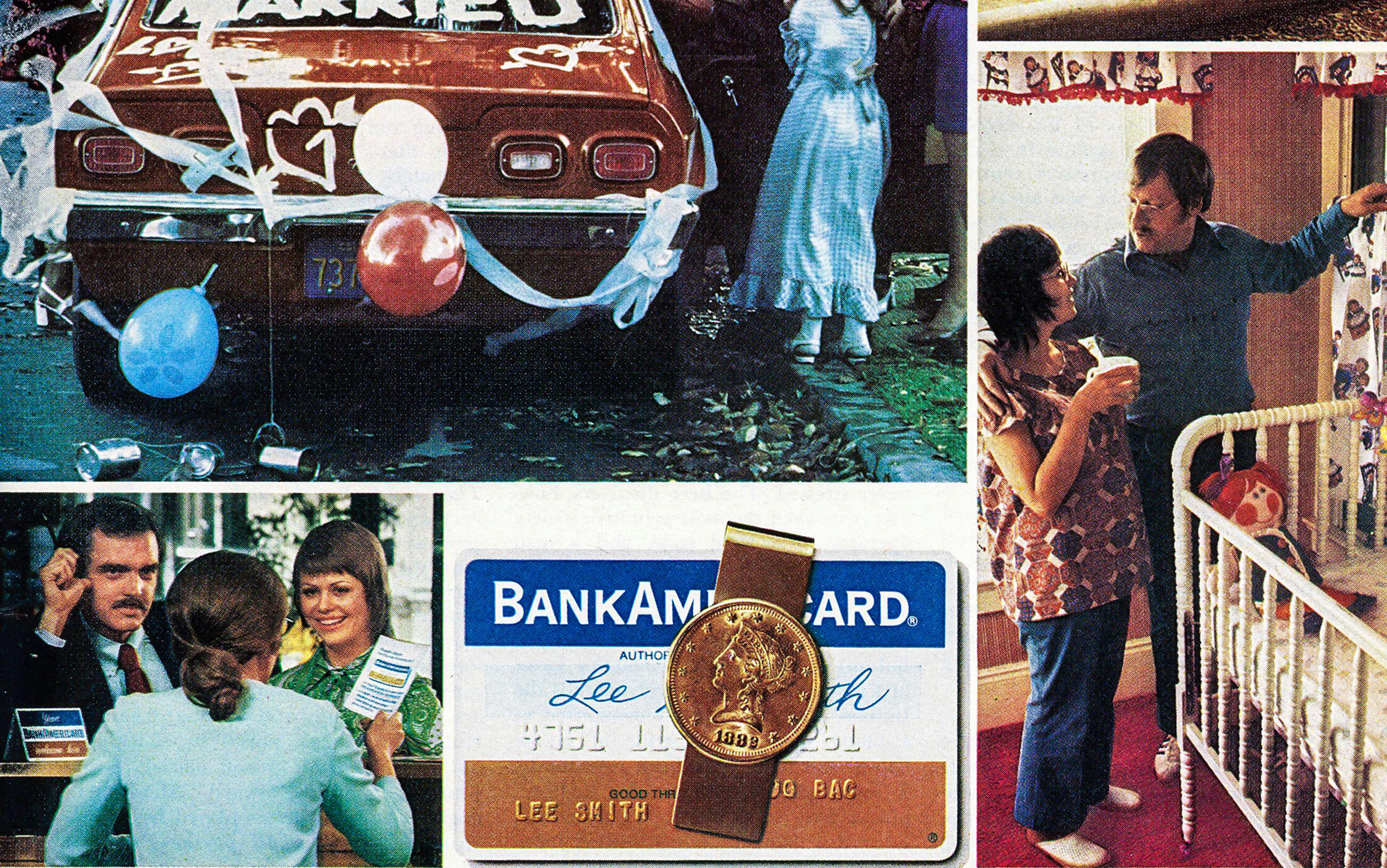
The problem is not so much that she drove instead of walked such a short distance – of the many millions of journeys people make in London every day, only a quarter are on foot – it is that she wasn’t even aware enough of her urban environment to know that walking was a much shorter, more direct and more pleasant route to her destination. My student’s inability to locate herself in space, her failure to navigate her environment on her own and her reliance on and complete faith in technology to get her where she wants to be mark her as a member of the 21st-century urban crowd. What she had done – outsourced navigation to her phone, or to the satnav of her Uber driver – has become just another fact of life for so many who make their way along the streets of modern cities.
And there are a lot of us – according to data from the World Health Organization, more than 50 per cent of the world’s population now live in cities, with that number expected to increase to 60 per cent by 2030. And of those who do walk, a good portion are using smartphones to navigate. For example, in my home country of the United States, approximately 77 per cent of people own smartphones. And a Pew Research Center survey from 2014 reveals that roughly three-quarters of adults in the US said it was OK for people to use their phones while walking down the street, riding public transit or waiting in line. Another Pew study, from 2012, found that three-quarters of smartphone owners were using their phones for location-based information such as mapping and reviews of nearby attractions. And in 2016, a report in The Wall Street Journal noted that, between 2010 and 2014, there had been a 124 per cent rise in emergency-room visits by pedestrians distracted by mobile devices. An NBC video from 2017 shows a 67-year-old woman in New Jersey falling head first into an open cellar – gapingly large, with the doors standing well above the sidewalk – providing a stunning visual of just how distracted some of us have become. Some cities in Germany and China have even responded by building or adapting pedestrian lanes and intersections to counter the problem of texting walkers.
Our inattention to our lived environment is not universal, of course. Hunter-gatherer societies still exist in places where survival is dependent on an ability to read nature. But the majority of cultures have seen their disconnection from the environment (natural or built) grow over millennia. In his book The Spell of the Sensuous (1996), the American philosopher David Abram points to the alphabet as the earliest technology to estrange humans from the natural environment. Where once hunter-gatherers were dependent on a sensuous connection with nature – intimately familiar with the scents of the animals they hunted, sensitive to the sounds of predators, able to navigate by sight – writing ensured that the human gaze was deflected from the real world to its representations.
That this deflection is now achieved through glossy, colour screens rather than the crudely drawn pictographs of early times matters little. For most, especially those of us in cities, it has been a long time since our relationship with our environment has gone unmediated by technology, and we are not likely to feel the loss of a direct and sensuous connection to the earth acutely. It is, after all, not necessary for the urban inhabitant to sniff the air for a predator, to know which plot of dirt hemmed in by concrete ledges might best support grains. There is no need to know how to identify the droppings of animals in city parks and, even without weather apps, there is no pressing need to scan the sky for showers or note drops in the barometer to assess when the rain might come – the indoors is seldom more than a few steps away. For most, the day will not change in any appreciable way if they no longer can (or simply never could) locate Polaris in the winter sky or if they confuse a chestnut underfoot with a pecan.
The real problem is what is being passed by and through, unseen or misunderstood, in the built environment itself. The urban landscape might be ignored, but the city is not silent. By design, it speaks. It nudges; it moves; it motivates; it persuades. The imposing curve atop St Paul’s Cathedral, the severe and minimalist thrust of the Shard, the golden glow of Prince Albert’s statue perched high above Kensington Gardens – these draw our eye upward, their height signifying their power, their vertical lines and dominating scale drawing our eyes heavenward in worship of God, and money, and monarchy. They speak to, among other things, England’s imperial history, global and cultural dominance, and financial might.
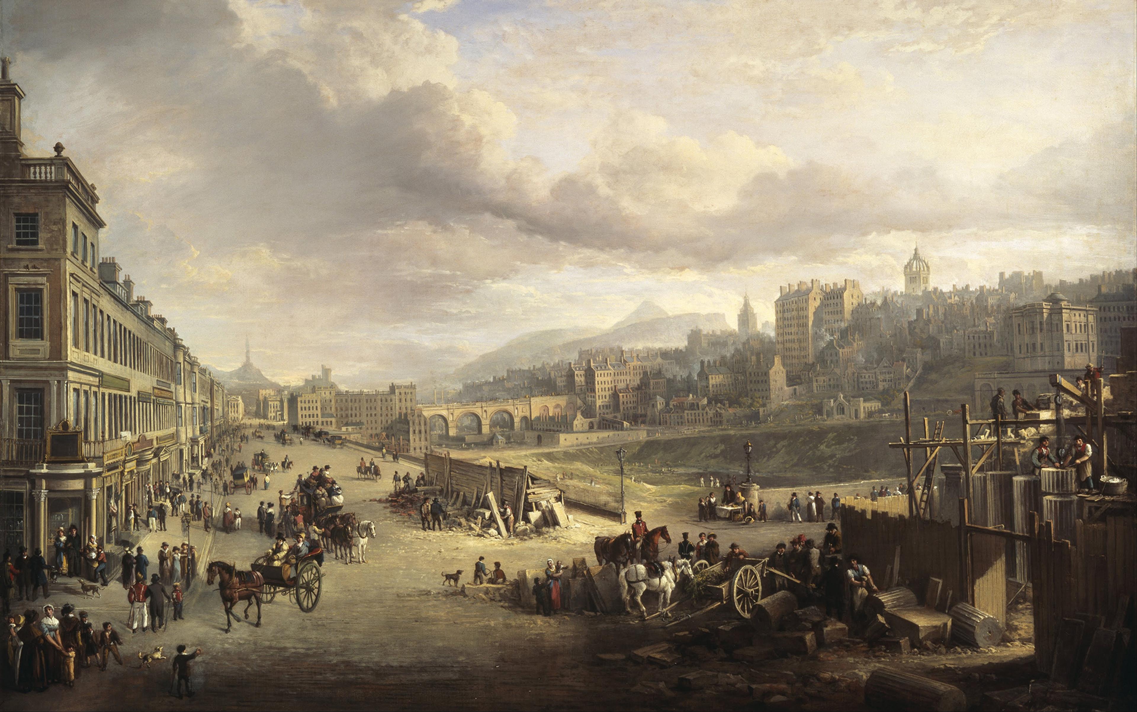
The socioeconomic divide looms large in the urban environment. Our cities communicate socioeconomic, racial and gender boundaries as clearly as Charles Booth’s 19th-century poverty maps. Our cities broadcast rules about who is invited in and who must be kept out. When we silence the city to pick up our phones, when we turn our gaze from the city’s stories to digital maps, we see only distorted selections of reality, bounded by frames, decontextualised, giving us the false sense that our journeys are imposed on the city, mapped over it rather than through it. These maps and apps flatten, simplify and neutralise space that is in reality three-dimensional, complex and rhetorical. The cool, smooth touch of the smartphone screen gives no hint of the possibilities for tactile interaction or architectural nudging. Every line mapped from point A to B seems equally accessible to everyone, regardless of age, class, race or gender. Issues with road construction and traffic are the only obstacles noted, as if the city were a playground open to all.
The poor depend on good sidewalks, clean public parks and high-quality public spaces in which to gather
It is at street-level, at walking pace and, perhaps most importantly, without screens, that one can stay fully attuned to the messages conveyed by the built environment. Though we might have long ago fled our hunter-gatherer roots, when untethered to electronic devices we remain fully human, our senses our surest guide to what appeals and engages. As the Danish architect Jan Gehl explains, ‘the speed at which we move is crucial. Rooted in biological history, the human sensory apparatus is designed to perceive and process sensory impressions while moving at about 5 km/h.’ It is built to scan the horizon, to take in the periphery. The faster we go, the greater our tunnel vision, as the urban planner Nick Jackson of Toole Design in Boston puts it. The slower we go, the more we look around us, the more likely we are to react to design elements such as signage prohibiting behaviours, intricate facades dominating private spaces, roads paved without cycle tracks for cyclists, large potted plants discouraging loitering, or ornate gates closing off access – in other words, the rhetoric of the urban landscape.
Public spaces in cities are palimpsests, under constant erasure and revision, and the traces of power and privilege that shape their every line are visible to the observant and the engaged. Just as prestige is inscribed in public space – in towering financial districts, the spires of churches, the raised arms of mounted soldiers cast in bronze, the well-tended gardens of Palace Gardens Terrace in Kensington – so too is its opposite. The poor, having far fewer amenities and far less access to travel, restaurants and good housing, depend far more on good sidewalks, accessible and clean public parks and high-quality public spaces in which to gather and socialise than the middle class and wealthy, as Enrique Peñalosa, the mayor of Bogotá and a champion of public spaces, argues. In 1800s London, the wealthy of the West End remained oblivious to the crowding, poverty and disease of the East End; in the same way, modern visitors to Whitechapel – focused on the digital maps that get them directly to the trendy Cereal Killer Café on Brick Lane and the Instagrammable street art around Old Spitalfields Market – can easily miss the council housing in nearby Tower Hamlets (recently scheduled for demolition before a successful pushback by residents).
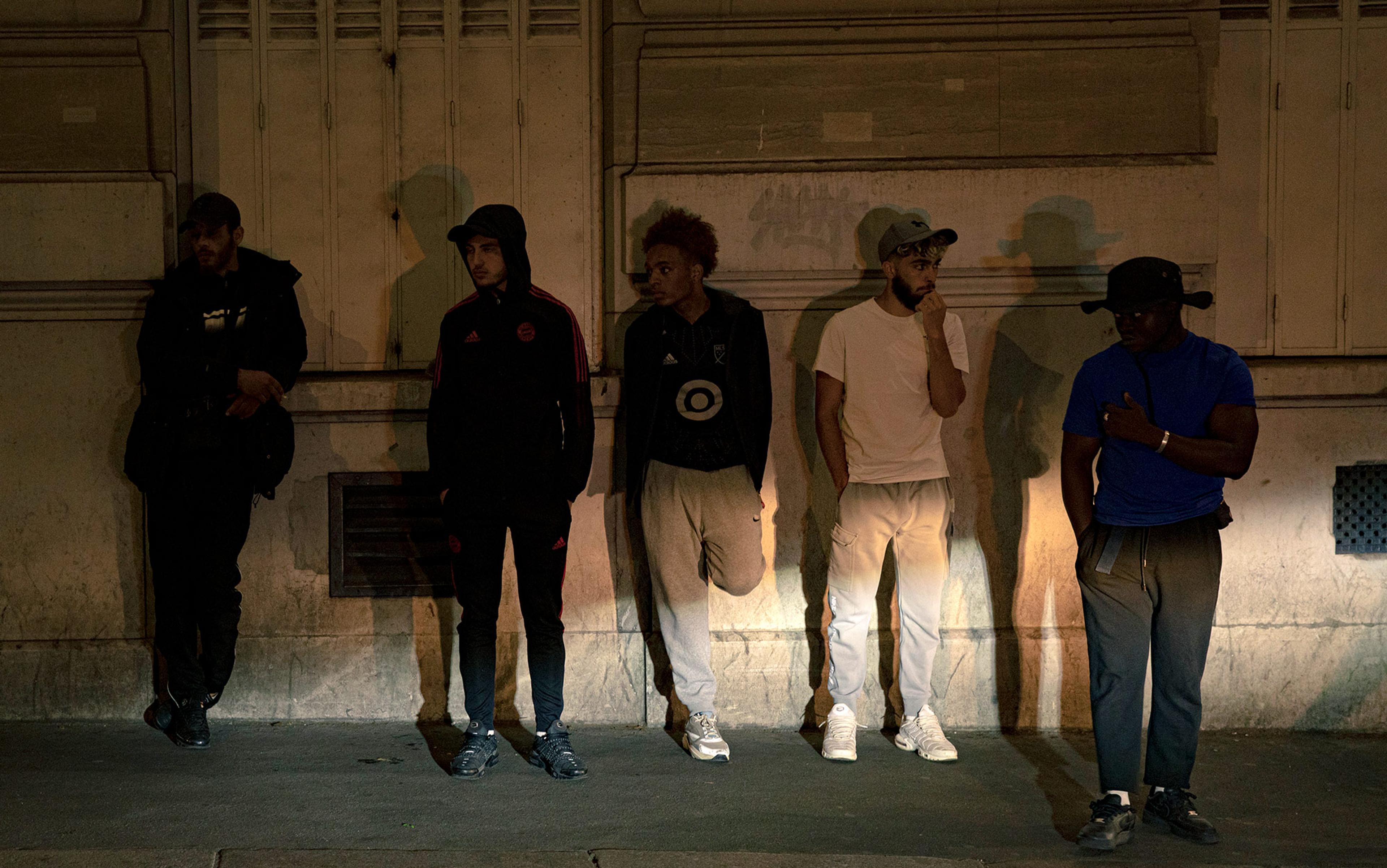
And many cities work hard to manipulate the built environment to discourage the presence of those it deems ‘undesirable’, which, for the most part (except for skateboarders) means the homeless. Hence the addition of so-called ‘defensive architecture’: built elements that nudge people out of spaces. These range from spikes on the tops of railings that prohibit climbing into public parks locked for the evening, to armrests in the middle of public benches to prevent napping. Ledges, windowsills and entryways are often studded with rounded metal spikes, not sharp enough to be dangerous but prominent enough to discourage sitting or lying down. Gated alleys, sloping bus-station seats and enclaves equipped with shower rails to drench the unwanted – all are current installations in cities such as London, which sees more than 700 people sleeping on the street a night. Such modifications to the urban landscape constitute a rhetorical practice often unnoticed by even the most well-intentioned urban inhabitant, and therefore go unchallenged.
While we stare down at our mapping apps or outsource our navigation to the nearest Uber to speed down city streets, architects, city officials, urban planners and design firms, among others, are paying increasing attention to the ways in which urban design speaks to urban inhabitants. The American urbanist William H Whyte (1917-1999), who wrote the seminal texts The Social Life of Small Urban Spaces (1980) and City: Rediscovering the Center (1988), set the stage for much of the data collecting and spatial observation now being conducted in cities. His groundbreaking work continues to have a huge influence on those, such as the aforementioned Gehl and the American urban planner Allan Jacobs, who are devoted to improving our experience of space and place. The question facing people invested in the life of cities is one of motivation – how, other than through explicit signage, penalties and prohibitions, can they influence the way we move through the city’s public spaces? More specifically, they study how the built environment can be designed so that people are ‘nudged’ to act in ways that are safe, sustainable and socially desirable. Small-scale interventions – chairs that can be moved, water features that add soothing sounds and visuals, the inclusion of ledges and edges on which to perch – have all been found to make spaces more inviting. Good lighting, the exclusion of bushes that might create hidden areas for illegal activity and safe bike paths for those without cars all make an area safer.
These professionals work on how the city can be made to ‘speak’ to its residents in ways that encourage democracy, safety and conviviality. But the German psychologist Julia Frankenstein warns that, in relying on GPS, we might be diminishing our cognitive maps, our sense of what is around the narrow routes we are shown on our screens. We might be learning to ‘strip-map’ our environment mentally. The people staring at a digital map neatly tracing a decontextualised line from the intersection outside Gloucester Road Tube station to the Whole Foods Market on Kensington High Street might not even see the beautiful, ornate railings and gates that enclose the private gardens they pass by, much less realise that they are not just aesthetically appealing but also mark the wealthy’s exclusive claim to some of the best green spaces in central London. The person staring down at a phone to get to the nearest Pret sandwich shop might fail to notice the allure of the nooks and crannies that line the streets of Hampstead Village.
History, too, is written in public spaces. The monuments and memorials to be found all over London – within cathedrals, atop hills, on the borders of the Royal Parks, alongside city pavements and dominating medians – offer the public narratives that frame collective historical memory, legitimising some losses while ignoring others, foregrounding certain figures and marginalising others, encouraging pride and containing grief, so as to prevent it from infecting everyday life. The huge statue of Prince Albert readily grabs the attention of even the most inattentive pedestrian in Kensington Gardens, but how many urbanites following their screens to Borough Market by London Bridge slow down enough to see Cross Bones, the small medieval graveyard in Southwark, or look closely enough to read of the thousands of unnamed ‘outcasts’ buried there. Their bodies, neglected or exploited in life and discarded in death, tell stories about infant mortality, poverty, prostitution and shame – stories that are not likely to reach the eyes of the distracted screengazer.
When, like my student, we lose ourselves in our reliance on digital tools for navigation, when we must look at an app to know that the River Thames is south of us, or must be directed turn by turn by Siri in order to make it from the Royal Albert Hall to Gloucester Road station, we not only deny ourselves the pleasures of the 19th-century flâneur, contribute to city pollution and incur a slight risk of ‘death by GPS’, we become unaware of the ways in which our cities are built to encourage, discourage, reroute, entice or keep out certain inhabitants, as well as the ways in which they are designed to celebrate the stories of some while marginalising the histories of others. When we silence the city to pick up our phones, the urban environment goes unread, its inhabitants unaware of the multiple monumental and mundane elements that shape their attitudes, actions and access, as well as those of their fellow citizens.