Aeon Video has a monthly newsletter!
Get curated editors’ picks, peeks behind the scenes, film recommendations and more.
Why did the Romans create a massive, entirely impractical map of their empire?
The Tabula Peutingeriana, or the Peutinger Map, is known for both its peculiar dimensions and uncertain origins. A parchment scroll a foot tall and 22 feet long, the map depicts the Roman Empire at the height of its power, spanning from Spain to India. While its emphasis on roads and population centres seems to imply it’s a transit map, it features cities that never existed simultaneously, and it places little focus on waterways, which were often the empire’s most efficient travel routes. Further complicating matters, the only version of the map remaining is a 13th-century copy of the likely 4th-century Roman original. In this light-hearted video essay, the US graphic designer and video producer Jeremy Shuback explores the many historical controversies and uncertainties surrounding the Tabula Peutingeriana. For the task, he enlists the help of Richard J A Talbert, a research professor at the University of North Carolina at Chapel Hill who spent a decade studying the map. Reasoning his way through its many idiosyncrasies, Talbert offers his view that the original was likely a way for Romans to demonstrate, above all, the scope and power of their empire.
Director: Jeremy Shuback

video
Politics and government
How it looked to Afghan women to see the Taliban return to power
33 minutes

video
Biography and memoir
Passed over as the first Black astronaut, Ed Dwight carved out an impressive second act
13 minutes
video
The ancient world
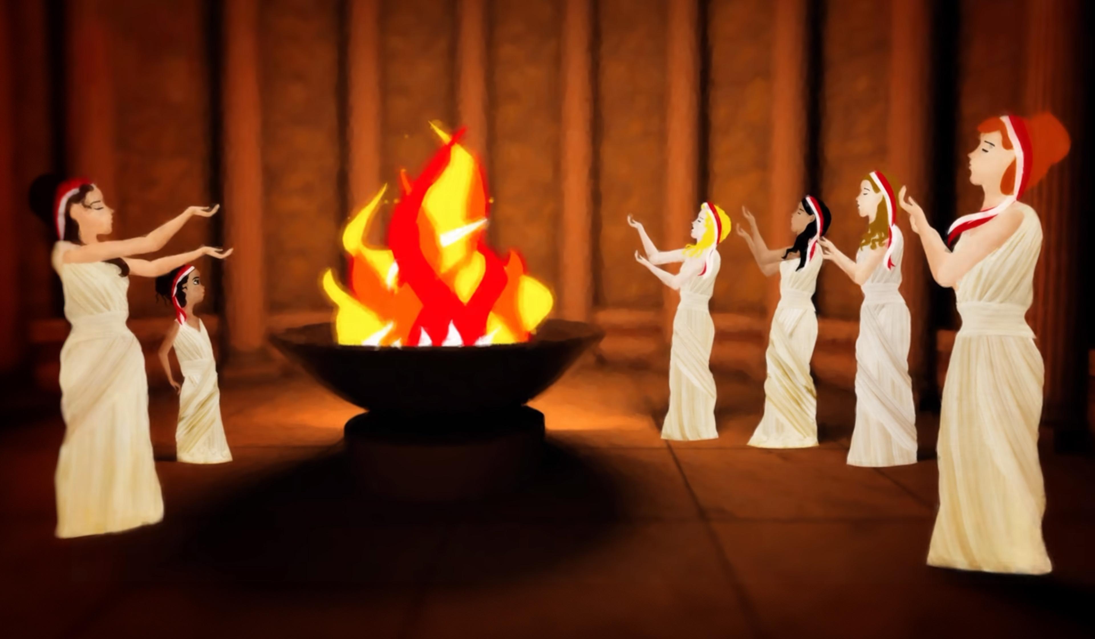
The six priestesses who kept the flame of ancient Rome alight at risk of death
5 minutes

video
Engineering
A close-up look at electronic paper reveals its exquisite patterns – and limitations
9 minutes

video
Architecture
West Africa was once an architectural laboratory. Is it time for a revival?
12 minutes

video
Work
A Swedish expat in the Philippines wonders: what’s up with people sleeping at work?
14 minutes

video
Art
‘If you’re creative, why can’t you create a solution?’ One artist’s imaginative activism
17 minutes
video
The ancient world
An ancient Roman’s hilarious (and perhaps relatable) response to a social snub
2 minutes

video
Death
A hunter’s lyrical reflection on the humbling business of being mortal
6 minutes