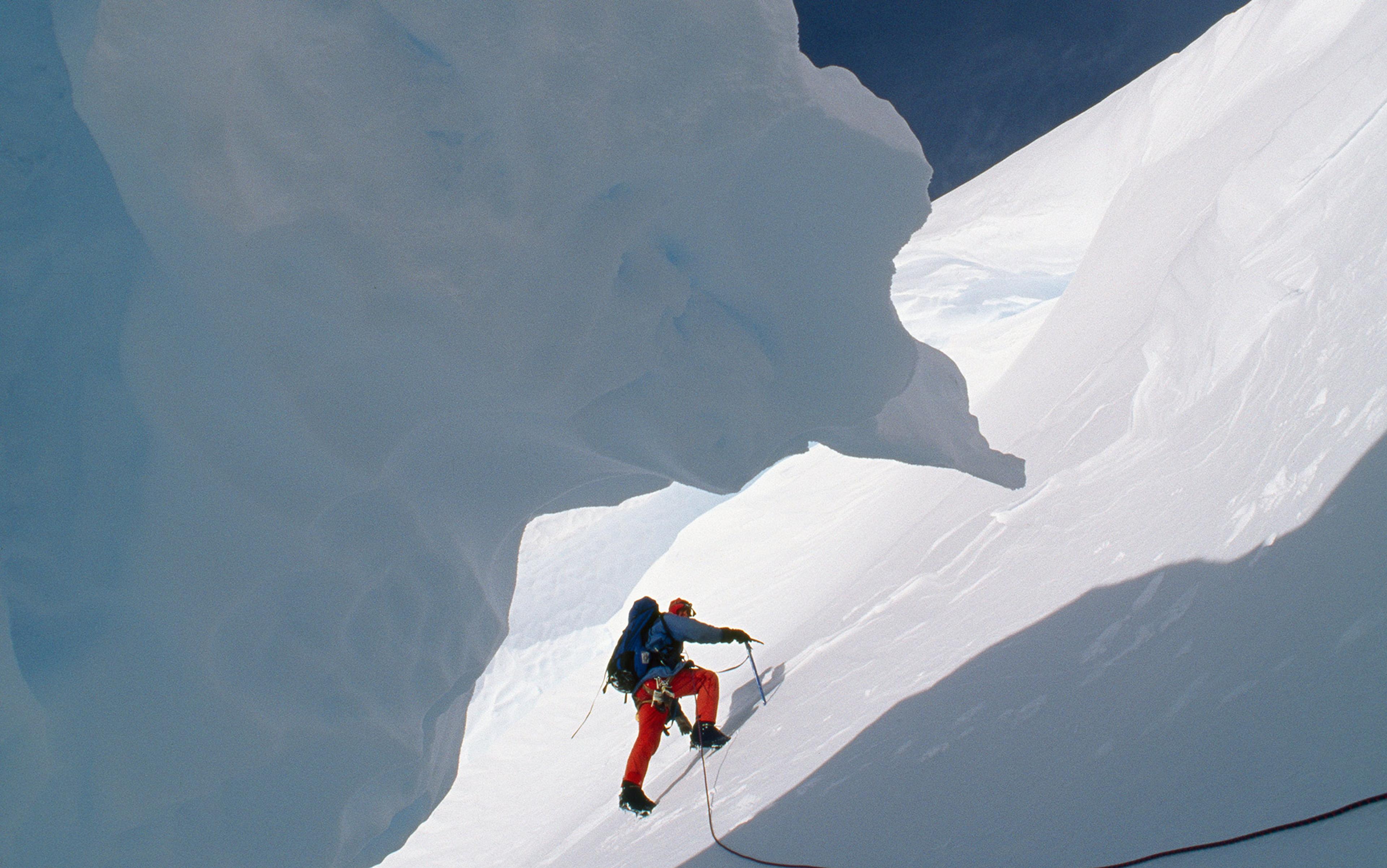
When a New York Times reporter asked George Mallory in 1923 why he’d want to scale Mount Everest, the British mountaineer is said to have replied: ‘Because it is there.’ A year later, Mallory perished in a fall within sight of Everest’s summit, but his quip lives on as the hackneyed rationale for mountain-climbing. The banality of those words, however, obscures a truly profound question: why is Everest – or any mountain – there?
Quite apart from the topographic and meteorological challenges they present, mountains have long posed intellectual difficulties for those who have pondered their meaning and origins. Following a trip to the Alps in 1671, the English theologian and natural philosopher Thomas Burnet described the montane landscape with revulsion, remarking that its ‘vast undigested heaps of stone’ defy any ‘tolerable account of how that confusion came in nature’. Seeking to understand why such atrocities would even be part of Creation, he noted with scholarly astuteness that mountains are absent from the first chapter of Genesis, and thus not original features on Earth, though they had apparently come into being in time for Noah and crew to wash up on the slopes of Mount Ararat. In his treatise Telluris Theoria Sacra (1681), Burnet suggested that the primordial Earth had been a smooth ‘mundane egg’ that cracked and released the Noachian deluge. Mountains were the resulting scars on the face of the Earth, their stern presence a reminder of, and punishment for, Man’s iniquity.
Burnet’s ideas are easy to ridicule, and were treated with particular scorn by Charles Lyell, one of the 19th century’s founding figures in geology. But as Stephen Jay Gould argued in Time’s Arrow, Time’s Cycle (1987), Burnet’s approach was rational, in that he was attempting to integrate sacred and secular knowledge into an internally consistent narrative. In fact, Burnet was correct on two counts: mountains are not primordial features; and mountain-building does involve disrupting the Earth’s outer ‘shell’ or crust. My own field, known as ‘structural geology’, concerns itself with the deformation of the planet’s crust, though of course we have long since abandoned notions of a primeval egg. The discipline is not as arcane as it might sound. We map active fault zones that generate earthquakes and ancient ones that host ore minerals or act as traps for petroleum. We help with the safe siting of large infrastructure projects such as tunnels, bridges and dams. And we document the way mountains grow.
Still, as recently as 1962, the year I was born, and less than a decade after Sir Edmund Hillary and Tenzing Norgay successfully scaled Everest, geologists still had no clear understanding of how mountains came to be there. At a time when the first test rockets for the Apollo programme were being launched, the origins of some of the most salient features on the surface of the Earth were no better understood than those on the Moon. In the preface to a 1963 graduate-level textbook, the geophysicist Adrian Scheidegger wrote this gloomy assessment of the state of ‘geodynamics’, or the application of mechanical principles to the deformation of the Earth’s crust and mantle:
Geodynamics is an old science. Most of the basic theories have been conceived in principle in the 19th century and not many fundamental ideas have been added since … geodynamics has been a highly speculative subject for about 100 years and it is not likely that this situation will change during the next 100. It is also unlikely that many basic new ideas will be added in that time interval … There seems to be no chance of settling the fundamental questions for a long time to come.
As it happens, the scientific paper that sparked the modern plate-tectonics revolution – an understated three-page article in Nature positing the phenomenon of sea-floor spreading – was published later that same year, cracking open the century-long impasse in geodynamics, and unleashing a flood of new scientific insights into the workings of solid Earth and the origin of mountains. Scheidegger’s words now seem almost ironic, like the heavy-handed foreshadowing of an amateur screenwriter.
But it is fascinating to listen in on the conversations among geologists who studied mountains in the century before plate tectonics. Many field-based geologists did excellent observational science that remains useful today, even though they laboured under a limiting interpretive paradigm. In contrast, some of the most prominent geologists of the time, less concerned with the messy ground truth of rocks than with staking a claim to a grand unifying theory, contributed to an elaborate fiction about the genesis of mountains that is almost as risible as Burnet’s erupting egg. Their ardent adherence to this theory exposes a basic tension in the study of the Earth: whether it can be understood like the cosmos, subject to timeless laws, or more like a language, evolving and idiosyncratic.
The discipline of geology as a distinct branch of science began with stratigraphy – the study of layered sedimentary rocks. But rock outcrops are discontinuous; erosion erases strata, and soils and vegetation often obscure them, leaving only peephole views of the stony subterranean archives. Around 1800, the English canal digger William Smith (1769-1839) recognised that distinctive fossils occurred in the same vertical sequence in excavated bluffs from Somerset to Kent, like page numbers that allow reconstruction of a shredded manuscript. This made it possible to correlate strata in England and Wales with those across the Channel, and eventually around the globe.
In the United States, geologic mapping proceeded westward with the inexorable expansion of white settlements in the early 19th century. East-coast geologists noted that stratigraphic units in the mid-Atlantic states could be traced hundreds of miles inland. For example, golden sandstones quarried in Wisconsin in the Midwest for ornately gargoyled buildings were once called the ‘Potsdam Formation’ because they clearly correlated with rocks found near Potsdam in New York State. But these roving early stratigraphers discovered that, as one followed particular layers eastward from the midcontinent, there was an important change: their thicknesses grew by an order of magnitude. In the Midwest, where the strata were flat-lying, they were thin, while in the Appalachians, where they were folded and contorted, they were very thick. This (accurate) observation was the seed for a collective hallucination about mountain-building that would persist for a century.
James Hall (1811-98), the state palaeontologist of New York, the first president of the Geological Society of America, and an honorary foreign member of the Geological Society of London, first articulated in 1857 the idea that there could be a causal relationship between thick piles of sediment and the formation of mountain belts. Hall declined to explain in any detail why piles of sediment would necessarily fold themselves, but he alluded to gravitational instabilities within a shivering mass of watery clay, silt and sand. Hall’s idea was adopted and expanded by James Dwight Dana (1813-95), a Yale professor and author of the definitive encyclopaedia on minerals, Dana’s Manual of Mineralogy (1848), still in print today, in its 21st edition.
He conjured up a phenomenon and gave it a ponderous name but was vague about the mechanism behind it
Dana coined the terms ‘geosyncline’ and ‘synclinorium’ for the deep troughs that received the sediments that would become the crumpled strata in mountain belts. The term ‘syncline’ was already in use for U-shaped folds in rocks, and its antonym ‘anticline’, for arch-shaped folds. Dana’s neologisms suggested down-warping on a grander scale that could encompass the smaller buckles and crinkles within a mountain belt. He also recognised that Hall’s original conception of mountains spontaneously generating themselves from unstable heaps of sediments in crustal depressions didn’t fully explain their defining characteristic: their high elevations. Somehow, geosynclines had to be pushed up into lofty heights, which by analogy he named, inelegantly, ‘geanticlines’ or ‘anticlinoria’, without any suggestion for how these might arise.
Like Hall, Dana conjured up a phenomenon and gave it a ponderous name but was vague about the physical mechanism behind it, leaving lesser geologists to puzzle over exactly how the great Dana’s ideas might be manifest in the particular mountain belts they studied. In spite of its lacunae, by 1895, geosynclinal theory had become mainstream geologic dogma, and Dana’s Manual of Geology (1863), another bestseller, was the authoritative textbook of the day, influencing generations of geologists-in-training. In the fourth edition of 1895, Dana wrote:
The great facts to be explained in a theory of mountain-making relate: 1) to the preparatory geosyncline and its load of strata for the mountain structure; and 2) to the mountain-making events – the upturning, flexing, and faulting of the strata.
The second ‘great fact’ reflected the emergence in the 1880s of the new subdiscipline of structural geology, which was developing its own methods and vocabulary to describe the geometry of deformed rocks. In the Alps, the Appalachians, the Scottish Highlands and the Canadian Rockies, hardy field geologists created detailed maps and cross-sections of complexly faulted and crenulated rocks. The cross-sections – small masterpieces in ink and coloured pencil – are profile views of mountain belts as they would appear if cleaved vertically across their grain.
These depictions of the mountains’ interiors showed unambiguously that the rocks in all of the ranges had experienced significant amounts of horizontal contraction. The faults (fractures along which slip has occurred) invariably recorded ‘reverse’ or ‘thrust’ displacement, in which the upper block, or ‘hanging wall’ has been shoved up an inclined fault surface, like a mover pushing a piano up a ramp into a van. The carefully drafted (and scaled) cross-sections made it possible to ‘undo’ the buckling and fault-stacking graphically, restoring the rocks to the geometry they’d had at the time of their deposition, and allowing geologists to estimate the amount of lateral shortening they’d undergone as the mountains grew. Such horizontal contraction was hard to explain in a scientific paradigm in which the crust was assumed to be pinned in place, and deformation was thought to be driven solely by the vertical force of gravity.
In one herculean field season in 1886, for a survey commissioned by the Canadian government, the young geologist R G McConnell mapped an 80-mile transect through the heart of the Rockies from Banff in Alberta to Golden in British Columbia. Virtually all of McConnell’s observations, on the sedimentary rocks, the fossils they contain, the complex ways they are faulted and folded, and the relationships between the erosional topography, the hot springs and the structural features, have proven durable. His inferences about the origin and magnitude of shortening in the Rockies were particularly astute:
The thrust producing these crust movements and dislocations came from the west, and must have been highly energetic in its action, as some of the breaks are of huge proportions, and are accompanied by displacements of many thousands of feet. The faulted region is now about 25 miles wide, but a rough estimate places its original width at over 50 miles, the difference indicating the amount of compression it has suffered.
Today, a major fault that creates the first prominent cliff one encounters in travelling west across the Alberta plains is named for McConnell.
When continents were considered rooted on the globe, the source of such lateral force was a mystery
Meanwhile, in the Scottish Highlands, the geologists Benjamin Peach (1842-1926) and John Horne (1848-1928) were undertaking a similar survey of the much older Caledonian mountain belt. Although they didn’t get around to publishing their masterwork until 1907 – preferring ambles about the open countryside to the tedium of setting words on paper – they had by 1888 documented dramatic crustal shortening in the Inchnadamph district of northwest Scotland. Peach and Horne showed how small features observed at the scale of a single outcrop were often microcosms of the geometry of the mountain range as a whole, presaging Benoît Mandelbrot’s concept of fractals by almost a century. And they described the distinctive ‘architectural’ style that is now recognised in most mountain belts: the imbrication of fault-bounded rock slices, with the stratigraphic sequence repeated over and over in a tilted stack, like slabs of crusty snow in front of a plough.
At about the same time, the US geologist Bailey Willis (1857-1949) was studying folded rocks in the central Appalachians in Maryland and Virginia, and attempting to recreate their deformation in a scale-model apparatus in which layers of coloured beeswax representing the rock strata in miniature were progressively compressed in a glass-sided box with a moving wall driven by a hand crank. His systematic investigation of the relationships between rock strength, layer thickness, degree of shortening and fold wavelength anticipate modern computer models of ‘orogenesis’ or mountain-building.
In each of these mountain belts, it was undeniable that a powerful horizontal force had acted upon the sedimentary masses of the ‘geosynclines’, shoving rocks long distances and shortening them by as much as 50 per cent. But at a time when continents were considered to be rooted permanently at the same locations on the globe, the source of such lateral force was an almost insurmountable mystery. This is the point where geology left solid ground and stepped for several decades into the realm of the fantastical.
The most popular explanation for the intense squeezing that the structural features in mountains so clearly recorded was the contraction hypothesis, which posed that the crust of the Earth was shrinking. Dana was an early advocate, together with the Alpine geologist Eduard Suess (1831-1914), who was also the first to recognise palaeontologic similarities among the southern continents and to postulate that they were once part of a single ancient landmass, Gondwana. The idea of a cooling, shrivelling Earth was consistent with the cutting-edge science of the day, Lord Kelvin’s thermodynamics. Kelvin had been the bane of geologists for much of the second half of the 19th century, with his pronouncements that the Earth could be no older than about 40 million years, based on its present-day heat flow and elaborate, mathematically intimidating calculations of its cooling rate that few geologists could understand. By the end of the century, however, most geologists had resigned themselves to a foreshortened timescale, and internalised the idea that Earth was getting inexorably colder, on its way to eventual heat death.
According to the contractionists, mountain ranges were like the wrinkles on a raisin, and ocean basins were the inward involutions (in Suess’s view, Gondwana had not broken up; rather, down-warped areas had been inundated by the sea). Objections that some parts of the Earth’s crust showed signs of having been stretched, rather than shortened, were conveniently dismissed. The shrinking-Earth hypothesis acquired renewed credibility for another generation of geologists when the German geologist Hans Stille (1876-1966) wrote his opus Die Schrumpfung der Erde (1922), a sonorous synthesis of contractionism with geosynclinal theory.
In that and subsequent work, Stille introduced a scholarly taxonomy of geosynclines that seemed to be an orderly Linnaean-like classification but in fact created chimeras that geologists would chase unproductively for decades. There were ‘orthogeosynclines’, the proper ones, made of rocks that could be folded and that usually consisted of two subparts: a ‘eugeosyncline’ with volcanic rocks, and a ‘miogeosyncline’ without them. And there were ‘parageosynclines’, which didn’t quite measure up to the ideal, in that they were constituted largely of crystalline ‘basement’ rocks that were not amenable to folding. Stille further proposed that periods of mountain-building, or ‘diastrophism’, were episodic and global in nature – ie, that stresses would build in the contracting shell of the Earth until widespread failure occurred. There is a wrinkle ridge on the Moon, Dorsa Stille, named for him.
Stille, who would live just long enough to witness the plate-tectonic revolution, is best remembered today as a staunch ‘fixist’ who discredited the ideas of the German meteorologist Alfred Wegener (1880-1930), who dared to suggest to geologists that they had missed something obvious: continents had moved. But Wegener’s most vituperative critics were in the English-speaking world. The publication of his remarkable book The Origin of Continents and Oceans (1915) – a compendium of evidence that continents drifted, collided and broke apart – was spectacularly ill-timed, given the antipathy for all things German in the US and Britain during the Great War. This, combined with the irksomeness of someone from outside geology once again claiming to have revealed a great truth about the Earth, caused most geologists to treat Wegener’s ideas with disdain.
Current geology textbooks, in their brief historical reviews of tectonics, typically depict geologists’ 50-year rejection of continental drift as a rational scientific response, pointing out that Wegener did not have a plausible mechanical explanation for how or why continents would move about the globe. This is true. But if geologists of the time had looked honestly at the evidence Wegener presented, they might have been motivated to discover the mechanism for themselves.
Wegener himself freely admitted that he didn’t have an answer to the question, stating near the end of his book:
The determination and proof of relative continental displacements as shown by the previous chapters, have proceeded purely empirically, that is, by means of the totality of geodetic, geophysical, geological, biological and palaeoclimatic data, but without making any assumptions about the origin of these processes … The Newton of drift theory has not yet appeared. His absence need cause no anxiety; the theory is still young.
The best suggestion that Wegener had for the impetus behind continental motion was the admittedly half-baked hypothesis of ‘Polfluchtkraft’ or the ‘pole-fleeing force’, the tendency for crustal masses to slide toward the equator as a result of the slightly oblate shape of the Earth. And even if this had been enough to shuffle continents about the globe, it was hard to imagine what exactly they were moving over or through.
Newly declassified naval data revealed for the first time the strange world of the abyssal ocean floor
As a result, geosynclinal theory prevailed through the 1930s to ’50s, with further elaborations made as needed to account for new geologic information. Charles Schuchert (1858-1942), another Yale geologist, president of the Geological Society of America, and an expert on brachiopod fossils, contributed the concept of offshore ‘borderlands’ to explain the evidence that in some cases sediments had, problematically, come from the seaboard side of geosynclines. An imaginative palaeocartographer and devout continental ‘fixist’, Schuchert also drew maps with slender land bridges that provided safe passage for Gondwana’s land animals unlikely to have managed the swim from South America to Africa. Still, one of the most prestigious awards bestowed by the American Paleontological Society is named for Schuchert.
Geosynclines reached their apotheosis with the publication of a Geological Society of America special volume, North American Geosynclines (1951) by Marshall Kay, a stratigrapher at Columbia University. The masterwork was reissued in 1955, and again in 1958. Much influenced by Stille’s efforts to tame unruly nature through classification, Kay added further entries to the lexicon of geosynclines, illustrating his impressive command of Greek: ‘taphrogeosynclines’ were fault-bounded; ‘zeugogeosynclines’ formed on formerly stable continental crust; ‘paraliageosynclines’ were shallow and coastal, marginal to the real thing. Some contemporary geologists grumbled about the absurd proliferation of prefixes, but few, particularly in the US, were ready to cry that the esteemed professors had no clothes.
A lone exception was the British geologist Arthur Holmes (1890-1965) who as early as 1929 proposed that convection cells in the mantle – like rolling wheels beneath the crust – could be the motor for both Wegener’s continents and the explanation for mountain-building. But even he declined to push the idea too hard, opting to present the most fully developed version of his theory in his geology textbook (like Dana’s, much reprinted) rather than face the savagery of peer review. Meanwhile, in his 1963 treatise on geodynamics, the pessimistic Scheidegger gave sober analytical treatment, with carefully drawn diagrams and pages of equations, to the stresses in geosynclines, the geometric details of contractionism and, perhaps to demonstrate his broadmindedness, the potential magnitude of ‘Polfluchtkraft’.
Scheidegger’s book had just been printed when ‘the Newton of drift theory’ appeared (as Wegener had predicted) in the guise of newly declassified naval data that revealed for the first time the strange world of the abyssal ocean floor. Bathymetric charts and corresponding maps of the magnetic properties of deep-sea rocks provided the critical clues to the mechanism for moving the continents. That is, seafloor spreading, in which fresh volcanic ocean crust is continuously produced at submarine ridges, and then forced outward as successive batches of basaltic magma rise. But it took several years before the complementary process, subduction, was understood, and this, at last, provided an explanation for how mountains grow.
When seafloor basalt is around 150 million years old, and hundreds of miles from its natal ridge, it has become about as dense as the underlying mantle, and sinks back into Earth’s interior at a slant, pulling the rest of the plate behind it like a blanket sliding off a bed. Holmes had been right – mantle convection was the key, but the convection cells were not deep subterranean rotors – they included the crust. (And to be fair to disciples of geosynclinal theory, the vertical pull of gravity is, in the end, responsible for horizontal plate motions.) The process of subduction recycles ocean crust and generates devastating earthquakes, but over longer timescales is a constructive phenomenon, since it sets the stage for mountain-building. Many subduction zones occur close to coastlines, as in the case of western South America, where part of the floor of the Pacific Ocean plunges eastward beneath the continent. In such a setting, if a subducting slab of ocean crust is towing a continent, an eventual head-on collision between landmasses is inevitable. That’s why Peach and Horne’s Scottish Caledonides, Willis’s Appalachians and Mount Everest itself are there.
Can we find any trace of geosynclines in all of this? The seminal observation that sedimentary sequences in mountains tend to be thicker than in continental interiors was accurate, but today we recognise that this is because sediments accumulate on continental shelves, which are simply the leading edge when continents collide. As Peter Coney, a structural geologist at the University Arizona, noted wryly in 1970: ‘Saying geosynclines lead to orogeny [mountain-building] is like saying fenders lead to automobile accidents.’
In truth, we have not yet achieved a full Newtonian understanding of mountain-building, because, like Leo Tolstoy’s unhappy families, mountain belts are each contorted in their own way. Their architecture depends on so many antecedent variables: the specific geometry of the tectonic convergence, the particular rocks involved – each with their individual biographies. Many of the great mountain belts in the world, like the Andes and McConnell’s Rockies, haven’t involved actual continent-on-continent pile-ups. In the case of the Canadian Rockies, it seems that a series of smaller unsubductable factors such as Hawaiian-type islands or orphaned continental fragments might have careened into western North America and raised the mountains. The Colorado Rockies, somewhat younger, are strange because they formed far inland from the plate boundary and don’t seem to have involved a collision at all. Instead, the cause of crustal shortening might have been subduction of a still-buoyant ocean plate that refused to go quietly into the mantle, raising welts in the continent above.
Erosion and tectonics interact in a complex manner in which cause and effect become blurred
In the past decade or so, we have gained an appreciation for how mountain-building is not in fact driven purely by tectonics but by the subtle interplay between tectonic processes and the external agents of erosion even as mountains are forming. Some of these insights have come from a new generation of scale models that, together with computational ones, allow us to watch mountains growing in real time. Among the most elegant ideas to emerge is ‘critical taper theory’, which posits that the outer part of a growing mountain belt – where shelf sediments are shoved up onto the adjacent continent – can be approximated by a wedge of sand being pushed by a bulldozer blade.
At first this seems counterintuitive since, unlike sand, rocks have cohesion; but as tectonic shortening builds mountains, the rocks caught up in the deformation are on the verge of failure everywhere, at every scale, and thus effectively like a granular mass. With continued squeezing, this ‘orogenic wedge’ grows toward the continental interior as new material is added by imbricated faulting at its toe – precisely the geometry that Peach and Horne observed in the Scottish Highlands. To a first approximation, the shape of the wedge – the ‘critical taper’ – is a function of just two variables: the friction at the base of the thickening rock pile, and the average strength of the rocks themselves. If the basal friction is low and the internal strength is high, a mountain belt will be wide but not particularly tall. Conversely, high basal friction and low rock strength will create a narrow, but lofty range.
However, even as the mountains are growing, erosion is altering the shape of the wedge, and might cause it to become ‘subcritical’, or too thin for its particular combination of friction and rock strength. As a result, new faults and folds will form within the wedge to restore it to its equilibrium shape. The astounding implication of this is that a mountain belt in an arid climate with low erosion rates can actually have a simpler cross-sectional geometry than one in a wetter climate where erosion forces continuous faulting and folding to maintain the stable wedge shape. In other words, climate-dependent erosion can dictate the internal architecture of mountains, in addition to sculpting them from the outside. But of course, mountains themselves can influence climate, so erosion and tectonics interact in a complex manner in which cause and effect become blurred. Together, these forces acting from within and from without create the horns, hogbacks, chimneys, spurs and summits that are so irresistible to climbers.
After a century-long reign, geosynclinal theory fell precipitously from grace, and soon became something of a shameful secret, an episode of mass hysteria during which several generations of geologists spent their careers studying unicorns. Today, most geology students have never heard the word geosyncline, and maybe that’s just as well. Can anything useful be abstracted from this regrettable intellectual cul de sac?
Any field that concerns itself with entities that evolve must constantly navigate between the general, timeless laws that shape them and the specific ‘timeful’ paths by which they unfolded (or, in the case of mountains, folded). The environmental physicist John Harte in 2002 described this as a ‘synthesis of Newtonian and Darwinian worldviews’. The timeless, ‘Newtonian’ habit of mind seeks patterns that reveal universal laws, attempts to remove ‘noise’ from ‘signal’, and is typically reductionist, predicated on the idea that the ‘closer you look, the simpler things get’. In contrast, the timeful, Darwinian view, celebrates idiosyncrasy and contingency (what Gillian Beer calls the ‘prodigality’ of nature), disdains oversimplified caricatures of natural phenomena, and finds that complexity grows with increasing scrutiny.
Neither is the ‘correct’ view of the natural world, but both are essential. Without the filter of a framing theory, the firehose of information from nature can be too great to process. On the other hand, intellectual preferences for simple explanations can lead to dangerously blinkered vision. The geologists who advanced geosynclinal theory were motivated by the Newtonian instinct, correctly detecting a pattern common to many mountain belts, but prematurely seeking generalisations about these prodigal natural phenomena – and then reifying their inventions through a lexicon that over time became realer to many geologists than the things it was meant to describe.
Fortunately, nature will always be messier, subtler, richer – and far more interesting than our cartoonish depictions of it. How wonderful to know that we live on a planet that is not shrivelling in its old age, but is vibrantly alive and self-rejuvenating, stirring its interior, reworking its surface, recycling its crust, and raising new mountains.
Why study mountains? Because once they weren’t there.