Thought to have been created around 1300 CE, the Hereford Mappa Mundi is the largest surviving complete map of the medieval world. Named for Hereford Cathedral where the map is housed today, the extraordinary document offers insight into the minds of Christian Europeans in the Middle Ages, revealing the extent to which their understanding of the world was shaped by stories from the Bible and the Classics. In this video essay, the US graphic designer and video producer Jeremy Shuback explores the map’s structure and the breadth of its illustrations, detailing how this imaginative piece of medieval cartography binds history, geography, mythology and religion to form an invaluable sketch of the Middle Ages.
The famed medieval map that stretched beyond Earth to heaven, history and myth
Director: Jeremy Shuback
16 March 2023
videoHistory of technology
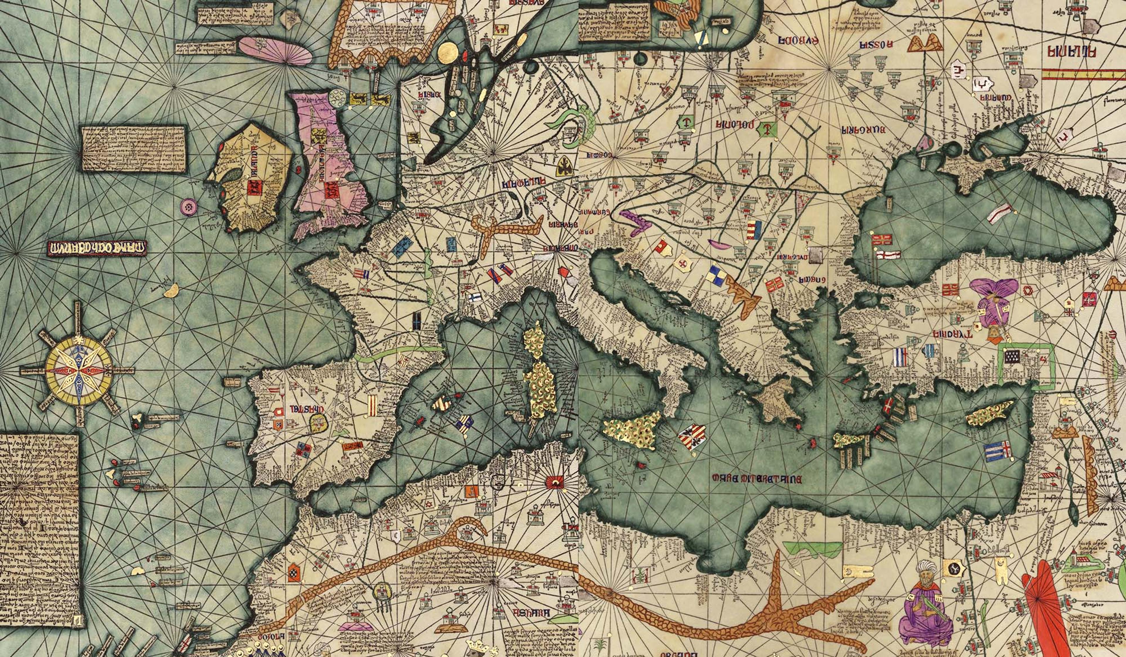
Master cartography and mythical creatures – the world according to the Catalan Atlas
8 minutes

videoArchaeology
How researchers finally solved the puzzle of the oldest known map of the world
18 minutes

videoThe ancient world
Why did the Romans create a massive, entirely impractical map of their empire?
7 minutes
videoHistory of science
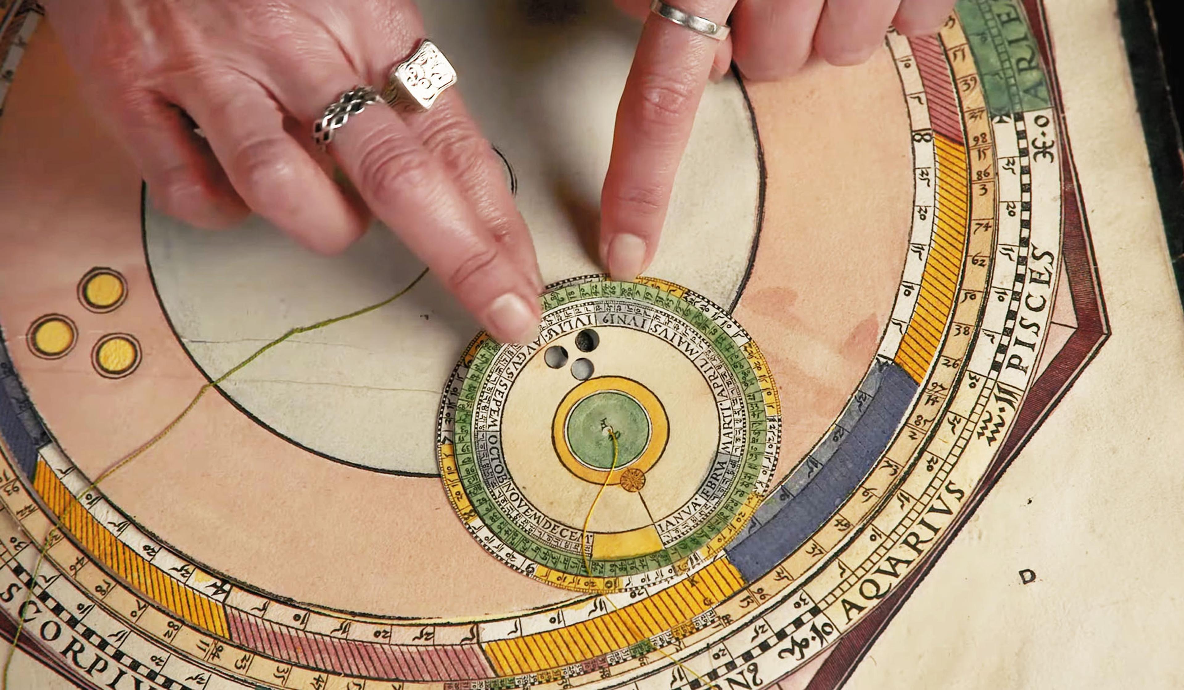
How one of history’s most beautiful books was used to find fate in the cosmos
6 minutes
videoHistory of technology
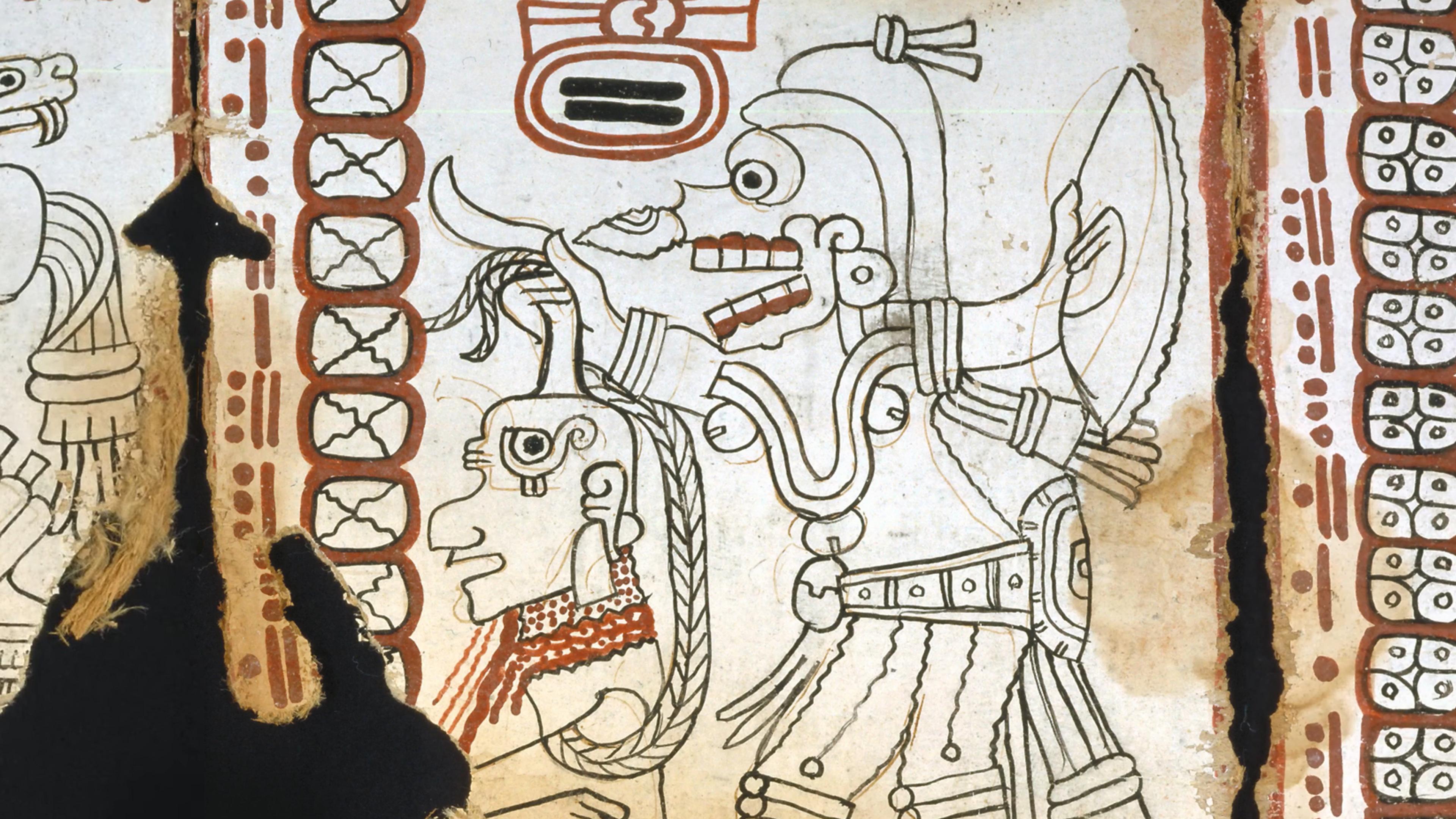
The Americas’ oldest book is an intricate work of Maya astronomy
9 minutes
videoCosmology
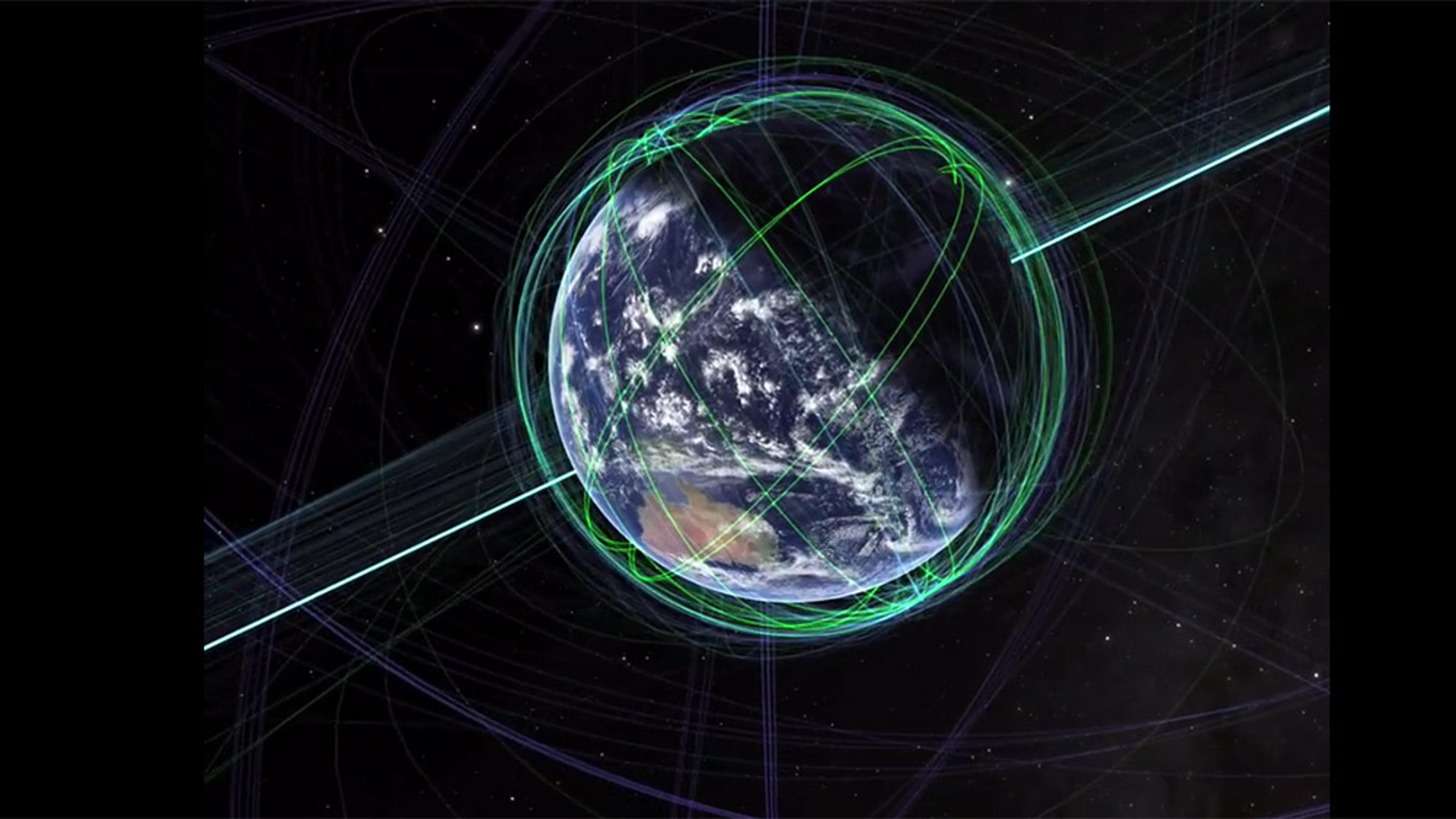
A journey from the Himalayas to the edge of our cosmic horizon in space and time
7 minutes
videoInformation and communication
Mapping data visualisation’s meteoric rise from Victorian London to today
6 minutes
videoArchaeology
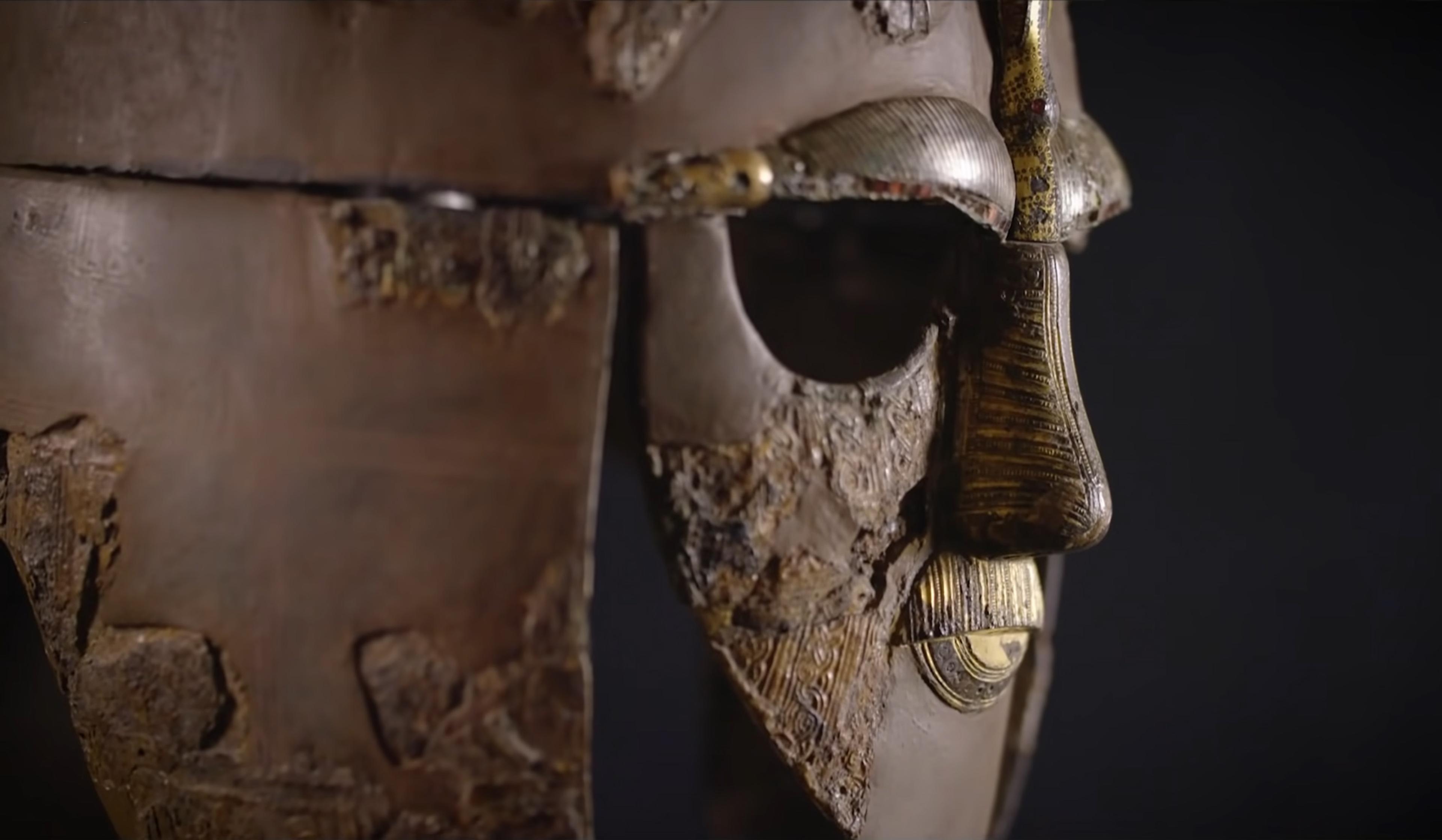
The meanings and mysteries of the iconic Sutton Hoo helmet brought vividly to life
19 minutes
videoThe ancient world
Explore the vast road network that made the Roman Empire possible
9 minutes