On 25 May 1961, the US president John F Kennedy announced the Apollo programme: a mission to send humans to the Moon and return them safely to Earth within the decade. The next year, the American geologist Eugene M Shoemaker published an article on what it would take to accomplish the goal in American Scientist. It is an extraordinary document in many ways, but one part of his assessment stands out. ‘None of the detailed information necessary for the selection of sites for manned landing or bases is now available,’ Shoemaker wrote, because there were ‘less than a dozen scientists in the United States’ working on lunar mapping and geology.
It can be easy to take our maps, images and story of the Moon for granted. But over the past six decades, our cultural and scientific relationship with the Moon has been radically altered. Multiple robots landed on the Moon last year, and more are on the way. The Moon is a place and a destination – but this was not always the case.
To geographers and anthropologists, ‘place’ is a useful concept. A place is a collision between human culture and physical space. People transform their physical environment, and it transforms them. People tell stories about physical spaces that make people feel a certain way about that space. And people build, adding to a space and transforming it even further.
Some scholars have started using these concepts to think about extraterrestrial locations. In her book Placing Outer Space (2016), the Yale anthropologist Lisa Messeri observes that scientists often think about planets, both in our solar system and beyond, as places. Sometimes this is explicit, as in the case of a series of talks given by Carl Sagan titled ‘Planets Are Places’. In other cases, scientists express a sense of place indirectly through their practices and language. Messeri observes that planetary scientists conduct place-making primarily through ‘narrating, mapping, visualising, and inhabiting’ other worlds. ‘Importantly,’ Messeri writes, ‘one can be (or can imagine being) in a place. Place suggests an intimacy that can scale down the cosmos to the level of human experience.’
This idea stuck with me as I surveyed the history of lunar science and the history of exploration. It seemed that, even before the emergence of planetary science as a recognisable discipline, people were slowly but surely applying the practices of place-making to the Moon.
Centuries ago, a major reconceptualisation took place that made it possible for many to imagine the Moon as a world in the first place. New technologies enabled early scientists to slowly begin the process of mapping the lunar surface, and to eventually weave narratives about its history. Their observations and theories laid the groundwork for others to imagine the Moon as a rich world and a possible destination.
Then, in the 1960s, the place-making practices of these scientists suddenly became practical knowledge, enabling the first visitors to arrive safely on the lunar surface.
For much of history, the Moon was a mythological and mathematical object. People regarded the Moon as a deity or an abstract power and, at the same time, precisely charted its movement. It seemed to influence events around us, and it behaved in mysterious ways.
The Egyptians and the Babylonians were eager to understand and predict the motions of celestial objects, including the Moon. The Babylonians created extensive tables of measurements showing the position of the Sun and Moon at different times of the year. Using these tables, they could predict the appearance of new moons and the timing of eclipses. Theirs was one part of an evolving and interconnected mathematical tradition involving Egyptian, Greek, Arab and Hindu scholars.
To Aristotle, the Moon was embedded in a giant sphere with the other planets and the stars
This mathematical understanding was not divorced from the mythological. For many people in these cultures, predicting the motion of these objects meant being able to access religious truth or the ability to predict events here on Earth. Understanding the Moon mathematically meant gaining astrological or religious understanding.
Greek scholars applied mathematical analysis to the Moon, but they also began to theorise about physical mechanisms for the motions of the planets. To the philosopher Aristotle, the Moon was embedded in a giant sphere with the other planets and the stars. Earth sat at the centre of these nested spheres, which moved around Earth. These spheres were composed of a fifth element, aether, and they were incapable of any sort of change. Even if they were somehow worlds in themselves, in the Aristotelian model, the Moon and its sphere were an impenetrable barrier between our world and the celestial realm. The universe was literally divided into the sublunary and the superlunary.
In this view, the Moon is a physical object of sorts. But its nature makes it entirely divorced from our understanding, and completely inaccessible. Both of these qualities preclude the Moon from being considered a ‘place’ in any practical sense.
There were some who thought about trips to the Moon. Stories in religious traditions across the world tell of people travelling to the Moon. There were some thinkers before and after Aristotle who imagined that there were more worlds than just Earth. The ancient atomists discussed the possibility of worlds other than Earth, while other Greeks discussed the possibility of life on the Moon. This included Plutarch, who wrote about the Moon as both mythical and a physical object. But, to the extent that the Moon was thought about as a place, the notion was largely speculative or religious. And, by the medieval era, influential scholars rejected the idea.
In the Islamic empires and in Europe, the Aristotelian notion gained hold over the scholarly worldview. The Greek astronomer Ptolemy and others tried their best to modify this model to get better predictions of the motion of celestial objects. The more they did this, the more complex their suggested mechanisms became. The Moon was largely treated as one component of a complex geometry problem. Then, in the 17th century, European astronomers broke free from Aristotle’s grip, and laid the theoretical foundations for the Moon to become a place.
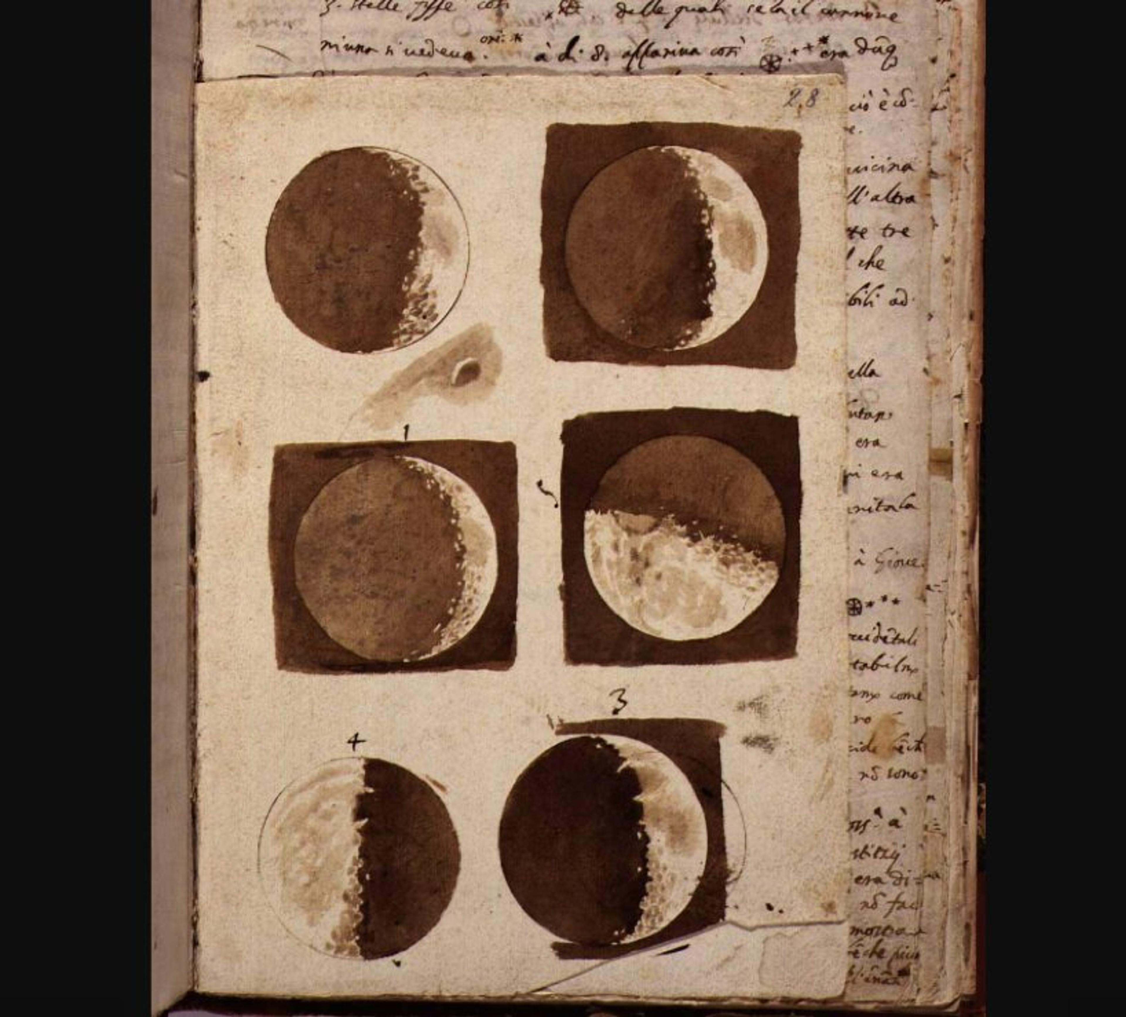
The first part of the story has been told often and well. The German astronomer Johannes Kepler built on the Copernican hypothesis that the Sun, not Earth, was at the centre of the system, overturning the Aristotelian notions of celestial mechanics and physics. Then the Pisan polymath Galileo’s view of the Moon through his telescope revealed an imperfect and rugged lunar surface, and new objects that did not seem to orbit Earth.
From Sidereus Nuncius (‘Starry Messenger’, 1610) by Galileo Galilei. Courtesy the National Central Library of Florence
As they prepared new maps in the 20th century, scientists looked back on the work that had preceded theirs, enabled by early telescopes of eras past. In their book Mapping of the Moon: Past and Present (1974), the astronomer Zdeněk Kopal and the cartographer Robert W Carder present a sequence of what they considered important milestones in telescopic mapping.
Galileo made illustrations of the Moon at the start of the 17th century, competently displaying the textures and shadows that he saw through the telescope. The English astronomer Thomas Harriot also made illustrations of his view through the telescope in 1609, and produced more map-like drawings of the visible features. But Harriot did not include any topography or texture. Later maps would combine these techniques, and add more elements that contributed to the sense of the Moon as a place. It was also around this time that astronomers started naming the features they saw.
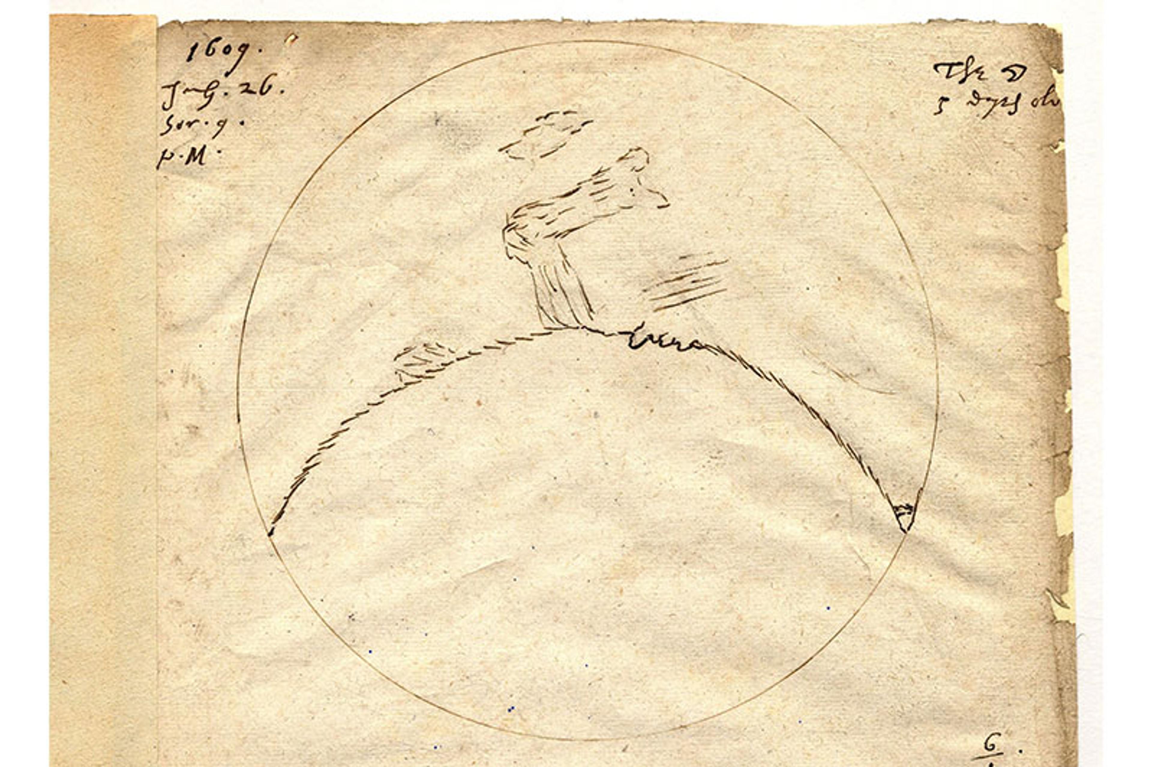
By Thomas Harriot, 26 July 1609. Courtesy Lord Egremont/West Sussex Archives/Petworth House
A Jesuit priest from Ferrara, Italy, invented the major lunar place names that we use today. His predecessors had created names based on their benefactors and confined to specific kingdoms. But Giovanni Battista Riccioli gave the ‘seas’, or ‘maria’, poetic Latin names. He named the various craters after philosophers and scientists from antiquity through to the modern era. If you look at his map from 1651, drawn up by Francesco Maria Grimaldi, you see familiar names such as Copernicus and Ptolemy, Mare Imbrium and Mare Tranquillitatis.
All this was hard to swallow prior to the 18th century, and it took philosophical and religious arguments to convince people in Europe. A contemporary of Galileo, the natural philosopher and bishop John Wilkins, laid out the case for this claim in his treatise titled The Discovery of a World in the Moone (1638). He crafted a fascinating argument, built on the observations of Kepler and Galileo, and couched in the rhetoric of his time.
Early telescopic observers explored the Moon long before the Apollo astronauts arrived
His first proposition is simply that ‘the strangeness of this opinion is no sufficient reason why it should be rejected.’ For context, he described other ideas once considered ‘ridiculous’ but later shown to be true. And because he worried that religious arguments would doom the idea of the Moon as another world, he addressed the problem of incorporating Aristotelian doctrine into the Christian concept of the universe.
After addressing these potential objections, Wilkins laid out his full argument in 12 more propositions. Depending on how you read them, about five are based on direct observation. He included evidence that the Moon has a solid body, that there are mountains, valleys and an atmosphere. The rest of the propositions are largely speculations about what this world might be like.
Wilkins imagined that such a world would not have been created by God without the intention that it support life. Wilkins interpreted the darker and lighter spots on the Moon as oceans and land, respectively. To Wilkins, this implied that the land must be inhabited, but he did not believe we could know much about the people who lived there.
The work is a fascinating look at the rapidly shifting intellectual currents of the 17th century. Galileo’s observations and Wilkins’s argument show that this idea was beginning to be taken seriously. In the coming centuries, with the telescope at the forefront, astronomers began to map the surface of the Moon, charting the mountains and the ‘seas’ of a new world.
But it’s Johann Tobias Mayer, an 18th-century German cartographer, whom Kopal and Carder credited as ‘the veritable father of lunar cartography’. Mayer used measurements with a micrometer to create a precise coordinate system for his mapping effort. The full versions of his maps, published after Mayer’s death, feature crisscrossing lines of longitude and latitude. By this point, maps of the Moon were beginning to look very much like maps of Earth.
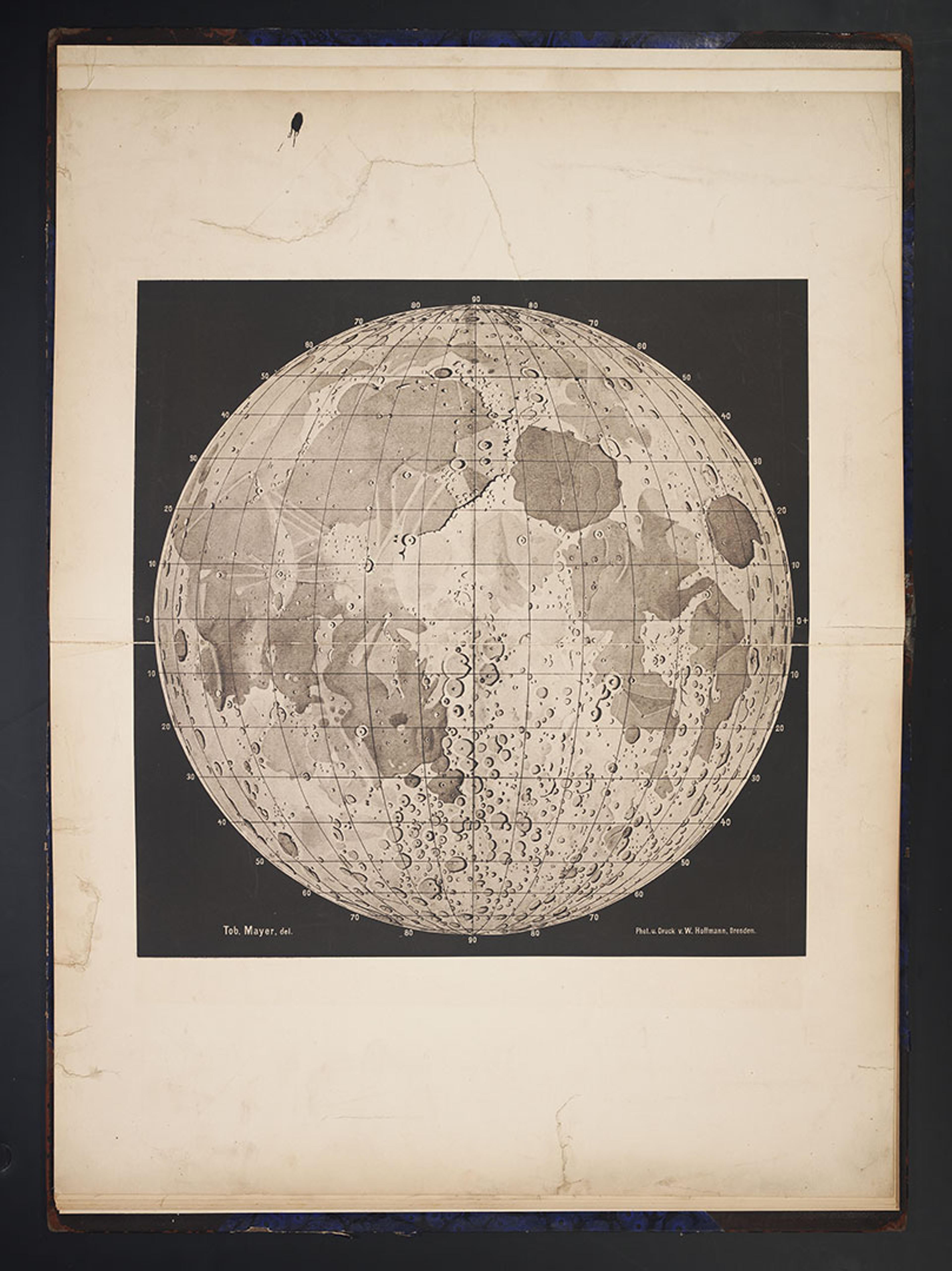
From Opera Inedita (1775) by Johann Tobias Mayer. Courtesy the Linda Hall Library
Lunar maps quickly became more detailed and complex and, as they did, the lunar surface seemed more like an intelligible and accessible place. In the 19th century, the invention of photography took this project even further.
By the 1850s, astronomers were taking useful photographs of the Moon on collodion plates. As the photographic process improved, high resolution telescopic imagery of the lunar surface became more common and accessible. At the end of the century, the Lick Observatory in California published an atlas constructed from photographs obtained with their 36-inch refractor telescope.
The German astronomer Johann Krieger’s use of these images demonstrates both their power and their limitations. While photographs were useful, Krieger knew that he could see far more detail through his telescope. He sought to create his own maps and, rather than starting from scratch, he decided to draw the missing details on top of the Lick Observatory photographs. The result was a series of partially photographic representations of various craters. The effort may have killed him, however. Krieger died in 1902, apparently of exhaustion.
In their own way, these early telescopic observers and their successors explored the Moon long before the Apollo astronauts arrived. The astronomers measured mountains on another world. They broke down the Moon into smaller regions, mapping them in detail using photographic plates in combination with their own direct observations.
With the Moon now appearing more like a tangible place and potential destination every day, popular culture climbed on board. The novelist Jules Verne began describing trips to the Moon, and movies from the French film industry depicted a lunar landing.
Yet the Moon itself was relatively neglected in the scientific world. Mapping efforts did not extend to serious analysis of what was on the surface, much less how to get there. The Moon was still out of reach, and largely shrouded in mystery.
At the end of the Second World War, it still was not clear to scientists how lunar craters were formed. Many believed that craters were the result of volcanic activity or other internal processes in the Moon. The fact that craters were almost universally circular on the Moon was a crucial part of the lunar puzzle.
As late as the 1950s, scientists still did not know much for certain about the Moon’s geology, and disagreed over whether you could apply geology to it at all. It had maps and place names, but within the scientific community, it did not have a story.
In his book To a Rocky Moon (1993), the American geologist Don Wilhelms argued that two scientists provided the essential clues for unravelling the mystery. The first was Grove Karl Gilbert of the United States Geological Survey (USGS), who studied craters on Earth, and suggested (all the way back in 1893) that large impacts caused the craters on the Moon. The second was Ralph Baldwin, who worked with bomb fuses during the Second World War, and independently came to the same conclusion based partly on his observation of craters created by explosives. He theorised that objects might impact the Moon with enough force to create the circular craters we see today.
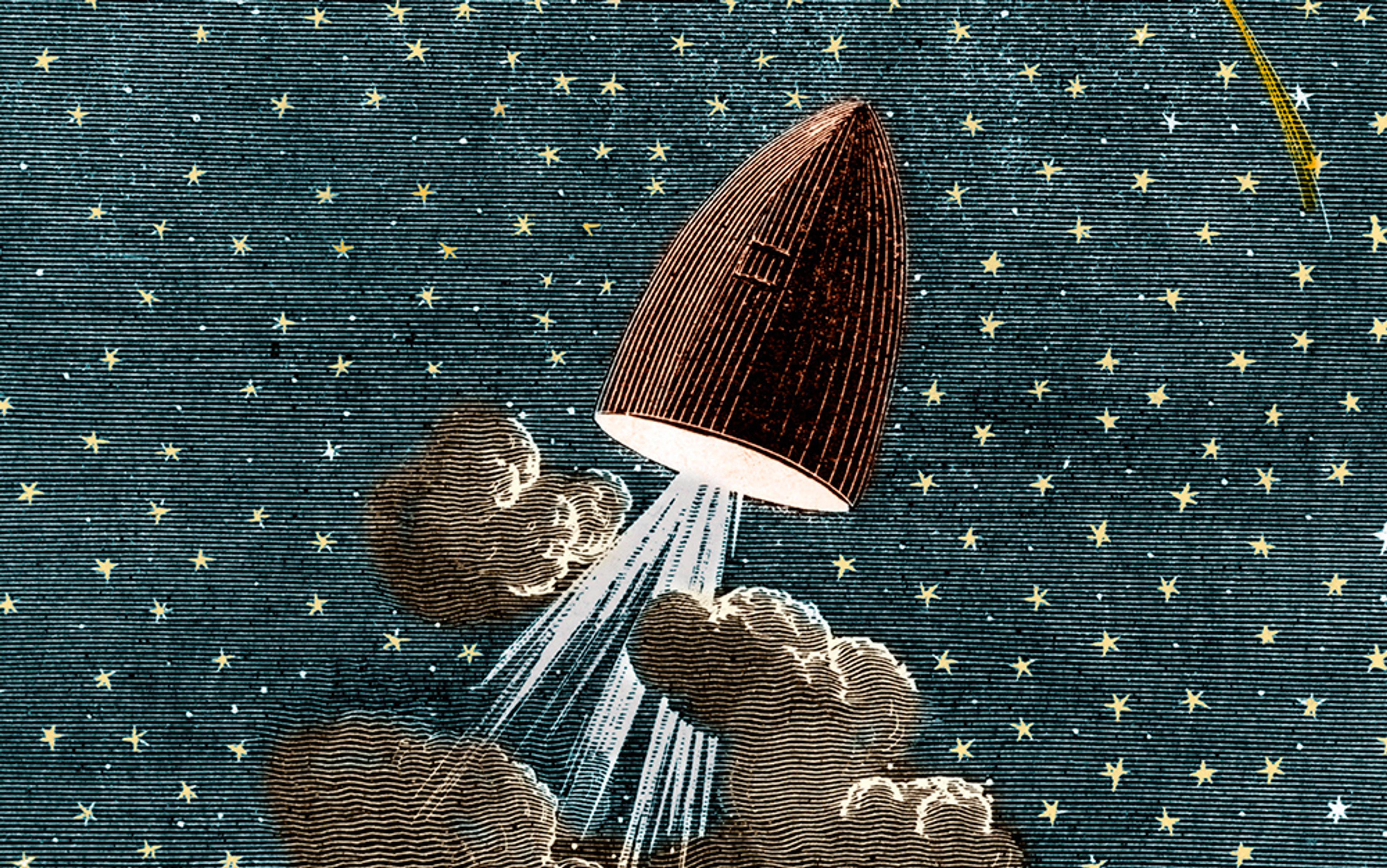
Then the Cold War motivated an entirely new type of lunar exploration. Rocket launches became a way for the US and the Soviet Union to signal to one another – and to the world at large – information about their military capabilities and the economic systems that supported them. But these demonstrations needed payloads and destinations that signalled peaceful intentions. It was here that scientists found an opportunity.
At first, it was physicists who were most interested in sending experiments to space on rockets, but geoscientists gave them a new destination. In 1959, the chemist Harold Urey convinced NASA’s new assistant director for space sciences, Homer Newell, that the Moon would be an interesting scientific target. Robots could give the geoscientists the closer look they needed, and successful trips to the Moon would give the US points in the Cold War. The US and the Soviet Union both began launching a series of robotic probes to the Moon, but the Soviets took an early lead when their Luna probes made impacts and captured the first images of the far side of the Moon.
The frontier narrative that Apollo spawned was a story based on American westward expansion
The US responded with the Ranger and Surveyor programmes. Ranger probes were sent to impact the Moon’s surface, taking pictures and measurements on their way. The Surveyor probes soft-landed on the lunar surface, where they conducted experiments and took pictures. The Ranger and Surveyor images were immediately subject to intensive analysis, as Wilhelms explained, and were used to modify theories of lunar geology.
Finally, with the Kennedy mandate gaining momentum, the preceding centuries of mapping – and the work of the scant few lunar geologists on the job – gained new significance. The mathematics of the Moon’s motion, the topography of its surface and the geological story of its evolution became directly and immediately relevant to national interests.
Lunar Orbiter became the first robotic probe designed to pave the way for human travel. NASA sent a series of five robots to orbit the Moon in 1966 and 1967 to search for landing sites. Engineers at Kodak equipped them with a clever mechanism to remotely transmit images taken on film. These images became the basis for new maps of unprecedented scope and detail.
The geoscientists went to work analysing the images, further altering their stories about the Moon’s history. But Kennedy’s deadline was rapidly approaching. NASA needed the geologists to focus on the selection of landing sites for the Apollo programme.
They used techniques that had roots in early topographical analysis to find flat spots that made for safe landing sites. And they used new geological narratives to find interesting sites that gave later Apollo missions more scientific value. The Egyptian American geologist Farouk El-Baz was one of the scientists who analysed Lunar Orbiter images for NASA. In his papers and the memoranda of the Apollo Site Selection Board, one can see, for the first time, theories of extraterrestrial geology being used to find destinations for practical human travel.
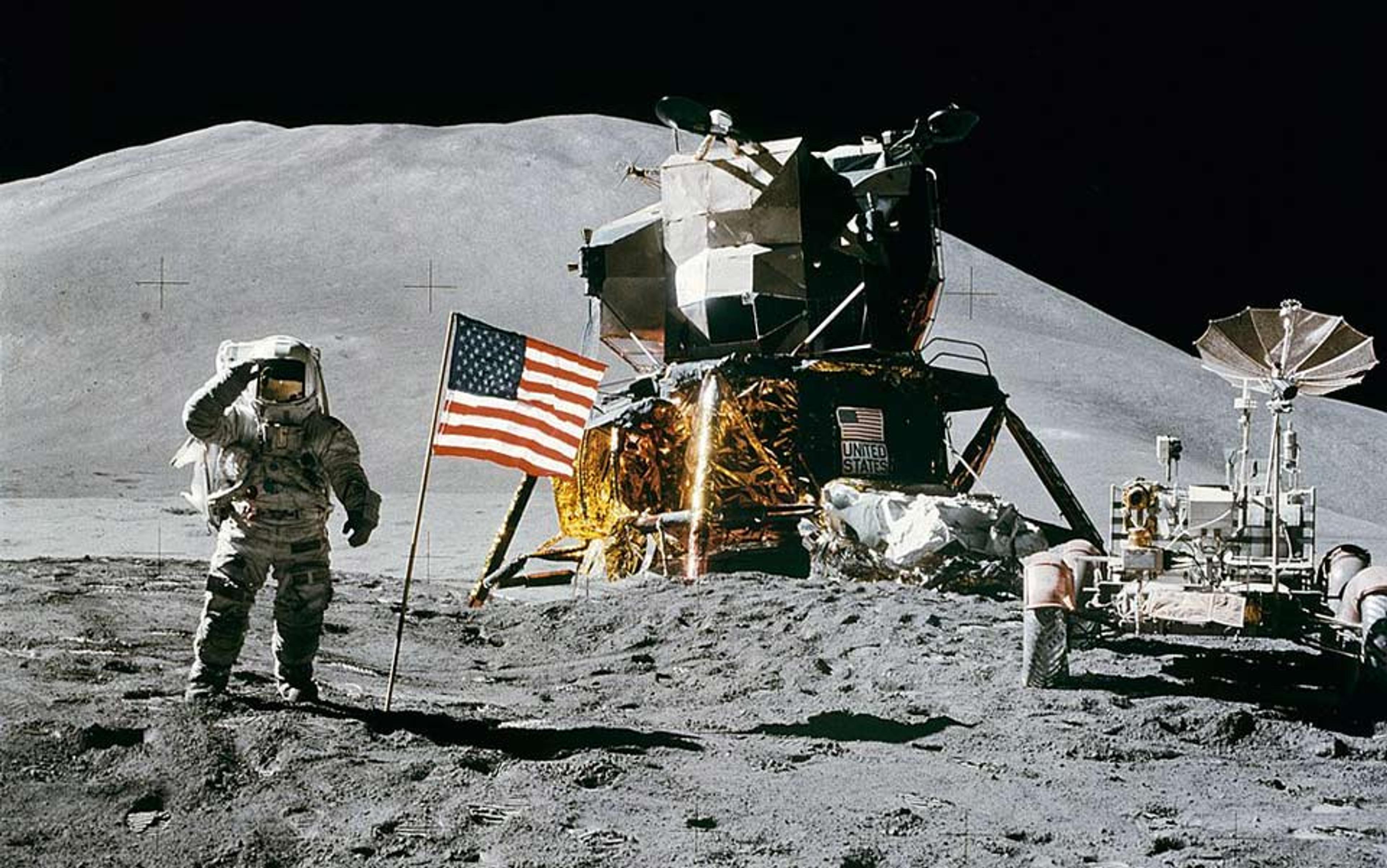
El-Baz and other geologists used the images from Lunar Orbiter to train the Apollo astronauts. They carefully studied the images, choosing landmarks that the astronauts could use to orient themselves once in orbit. The geologists of the USGS took the astronauts out to sites on Earth to prepare them for the work they would do on the Moon.
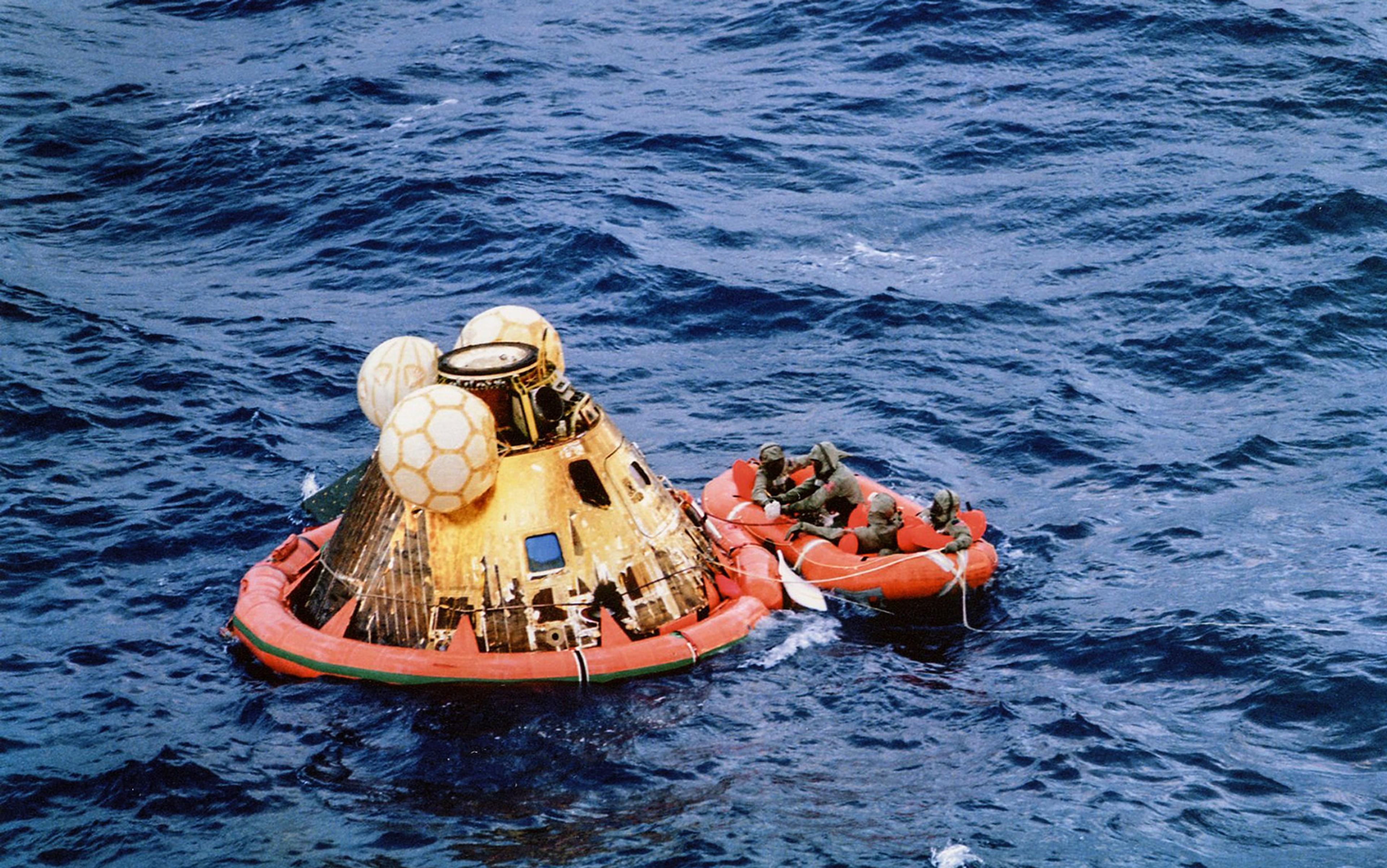
Some of the astronauts were not particularly interested in the geological work, or did not consider it an especially significant part of their mission. But, to the geoscientists, it was everything. The photographs and samples returned from the Apollo missions provided essential ‘ground truth’ that helped scientists test the geological theories developed using views from above. By the 1980s, they had incorporated what they had learned into a consensus theory about the Moon’s geological history.
In Placing Outer Space, Messeri discusses the frontier narrative that Apollo spawned. It was a story based on American westward expansion, and it captivated the political, scientific and popular audiences of the time. Shoemaker lamented that NASA abandoned a frontier-style project of scientific exploration after the Apollo programme. Messeri cautions against carrying that type of narrative forward into our new epoch of space exploration, and suggests that we should seek more cooperative and constructive visions of our relationship with outer space.
Perhaps there is an alternative suggested in this history. There are more ways to explore than simply having boots on the ground. NASA may not have fulfilled Shoemaker’s vision of human presence on the lunar frontier, yet it gave us a programme of scientific exploration that may have been difficult for people to imagine at the time – and continually rooted in the technologies and techniques being deployed in support of the Moon landings.
Robotics advanced so rapidly in the decades following Apollo that satisfying levels of ground truth could be obtained by landers and rovers on other worlds. The robotic exploration of the solar system in the second half of the 20th century provides us with a new model of exploration, an idea that historians of exploration such as Stephen J Pyne have begun to investigate. NASA and its robots have, themselves, become symbols of a new type of exploration, with the values of curiosity and perseverance providing names for the flagship vessels of exploration in the 21st century. And as our expansion into space accelerates, our views of the past will continue to shape the explorations and narratives that come next.